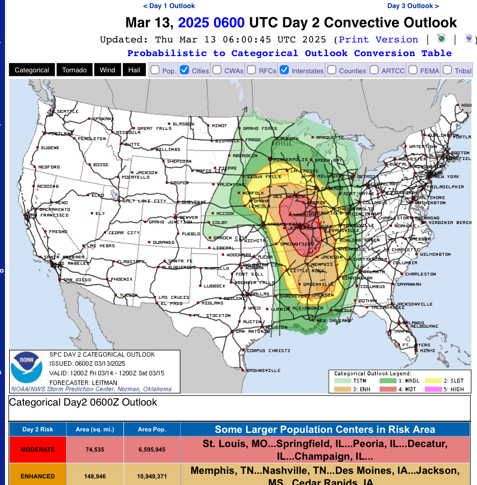
A significant storm system is poised to impact various regions across the United States on Friday, March 14, and Saturday, March 15, 2025. This system is expected to bring a range of severe weather conditions, including powerful thunderstorms, tornadoes, and heavy rainfall.
Friday, March 14:
• Severe Thunderstorms: A regional outbreak of severe storms is anticipated across much of the Mississippi Valley, extending eastward to the Lower Ohio and Tennessee Valleys. These storms may produce widespread damaging winds, several tornadoes (some potentially strong), and large hail.
• High Winds in the Southern Plains: The Texas Panhandle is forecasted to experience hurricane-strength winds, with gusts reaching between 60 to 70 mph. These conditions heighten the risk of wildfires and may lead to power outages and reduced visibility.
Saturday, March 15:
• Continued Severe Weather: The severe weather threat is expected to shift eastward, affecting the central Gulf Coast states, Deep South, and into the Ohio Valley. Significant tornadoes, swaths of damaging gusts, and hail are anticipated, particularly across the southern regions.
Additional Impacts:
• Northeastern United States: Connecticut and surrounding areas may experience cooler temperatures with partly sunny to mostly cloudy skies on Thursday, followed by showers on Saturday and steady, possibly heavy, rain by Sunday.
• California: An atmospheric river is expected to bring significant rainfall and strong winds to the Bay Area, with forecasts predicting about 2 inches of rain in San Francisco and winds between 30-40 mph, with gusts up to 60 mph in some areas.
This storm system underscores the importance of staying informed and prepared for rapidly changing weather conditions. Residents in the affected areas are advised to monitor local weather updates and follow guidance from authorities.

