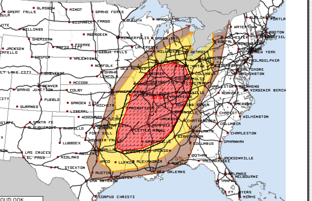
As of Friday, March 28, 2025, a major portion of the Midwest and South is under a significant threat of severe weather for Sunday, March 30. The National Weather Service forecasts a high near 87°F (31°C), approaching the record of 32°C set in 1946. Anticipated conditions include gusty thunderstorms capable of producing flooding downpours, hail, damaging wind gusts, and isolated tornadoes.
The Climate Prediction Center has highlighted a slight risk of heavy precipitation for parts of the Lower Mississippi Valley, including Baton Rouge, from March 28 to 30. This system is expected to strengthen as it moves eastward, bringing the potential for severe weather across a large portion of the U.S.

