
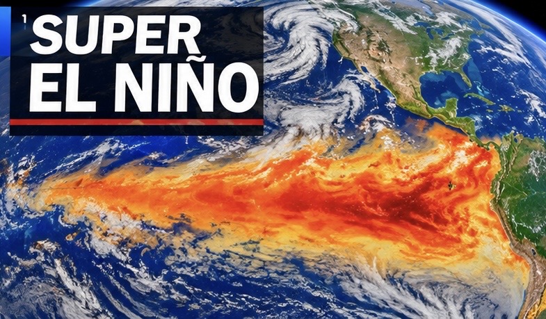
Super El Niño Raises Concerns for Global Weather Patterns Heading Into 2027
A potentially historic El Niño is drawing increased attention from climate scientists as ocean temperatures across the tropical Pacific continue to warm.
The latest outlook from NOAA’s Climate Prediction Center indicates that El Niño is expected to strengthen through the end of 2026, with a strong to very strong event likely to continue into early 2027.
Some climate models indicate the possibility of an exceptionally powerful event, potentially rivaling some of the strongest El Niño episodes observed since modern records began.
El Niño develops when sea surface temperatures in the central and eastern equatorial Pacific become warmer than normal. Those ocean temperature changes influence atmospheric circulation, shifting rainfall patterns, storm tracks and temperature trends around the world.
Depending on the region and season, El Niño can contribute to increased rainfall in parts of the southern United States, warmer or drier conditions in other regions, and changes in tropical cyclone activity.
Scientists are particularly interested in how a powerful event could influence the upcoming winter season and weather patterns extending into 2027.
However, El Niño does not guarantee specific weather outcomes. Regional conditions, other ocean patterns and atmospheric circulation will also determine how individual weather systems develop.
Weather takeaway: A potentially historic El Niño could have major implications for global weather patterns through the coming months. cpc.ncep.noaa.gov
Keywords: Super El Niño, 2026 El Niño, 2027 weather outlook, Pacific Ocean warming, ENSO, global climate patterns, winter forecast, ocean temperatures, NOAA climate outlook, extreme weather.
Hashtags: #SuperElNino #ElNino #ENSO #ClimateWatch #GlobalWeather #WeatherNews #NOAA #PacificOcean #WinterOutlook #2027Weather #ClimatePatterns
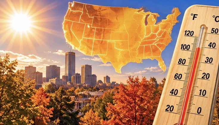
Unseasonably Warm Temperatures Spread Across Much of the United States
Much of the United States is heading into a relatively mild stretch of weather, with temperatures trending warmer than normal in several regions.
A changing weather pattern is allowing warmer air to spread across portions of the country following a period of cooler conditions. The Southern Plains and parts of the central United States are expected to experience generally mild conditions, while a building ridge later in the week could help maintain above-average temperatures across portions of the southern Plains and central Canada.
However, not everyone will experience the warmth. Parts of the Ohio Valley and Mid-South could still see chilly morning temperatures, with frost or freezing conditions possible in some locations.
The contrast between warmer conditions across much of the country and lingering cold pockets in the East highlights the changing autumn weather pattern.
Forecasters will be watching how the developing upper-level ridge influences temperatures heading toward the middle of November.
Weather takeaway: Much of the country is trending milder, but chilly mornings will continue in parts of the eastern United States. National Weather Service +2
Keywords: U.S. temperature outlook, warmer weather, November weather, above-average temperatures, autumn warmth, Southern Plains, weather pattern, temperature forecast, United States weather.
Hashtags: #USWeather #WeatherNews #WarmWeather #NovemberWeather #TemperatureOutlook #WeatherForecast #SouthernPlains #AutumnWeather #ClimatePatterns #WeatherUpdate

Pacific Northwest Braces for Another Round of Rain and Mountain Snow
Another active Pacific storm pattern is bringing unsettled weather to the Pacific Northwest, with periods of rain, gusty winds and mountain snowfall expected over the coming days.
Washington and Oregon are likely to see additional rounds of precipitation as disturbances move inland from the Pacific Ocean. Some coastal and higher-elevation areas could experience stronger winds and heavier precipitation.
Higher elevations of the Cascade Mountains are also expected to receive snowfall, creating potentially hazardous travel conditions through mountain passes.
The larger weather pattern is keeping the Pacific storm track active. Additional disturbances could bring more rounds of rain and mountain snow as the week progresses.
Although the immediate concern is persistent wet weather rather than a widespread severe-weather outbreak, repeated rainfall could create localized flooding problems, especially in areas with poor drainage.
Weather takeaway: The Pacific Northwest is entering another unsettled stretch, with repeated rainfall, gusty winds and mountain snow remaining the primary concerns. National Weather Service +3
Keywords: Pacific Northwest weather, atmospheric river, Washington rain, Oregon storms, Cascade snowfall, mountain snow, Pacific storm track, coastal winds, heavy precipitation.
Hashtags: #PacificNorthwest #WashingtonWeather #OregonWeather #AtmosphericRiver #MountainSnow #WeatherNews #WinterWeather #RainStorm #CascadeMountains #StormWatch
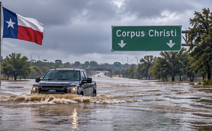
Texas Flooding Continues as Additional Heavy Rain Targets the Gulf Coast
Heavy rain and thunderstorms are expected to continue across portions of southern Texas into Monday, keeping the threat of flash flooding alive.
The National Weather Service Weather Prediction Center is monitoring areas stretching from south of Interstate 10 toward Corpus Christi and the Rio Grande Valley. Moisture flowing northward from the Gulf of Mexico is helping fuel additional rounds of showers and thunderstorms.
Some locations could receive another half-inch to an inch of rain on average, with locally higher amounts possible. Some forecast guidance also indicates the potential for heavier, localized rainfall along the Gulf Coast.
The flooding concern comes after previous rounds of rain have already saturated portions of the region. Rapid water rises could create dangerous conditions on low-lying roads, drainage areas and urban streets.
The overall storm system is expected to gradually weaken Monday, but residents should remain alert for additional rainfall and localized flooding.
Weather takeaway: The heaviest rainfall threat should gradually diminish, but southern Texas remains an area to watch through Monday morning. National Weather Service +2
Keywords: Texas flooding, South Texas weather, flash flood threat, Corpus Christi, Rio Grande Valley, Gulf moisture, heavy rainfall, thunderstorms, flood safety.
Hashtags: #TexasWeather #TexasFlooding #FlashFlooding #SevereWeather #WeatherNews #CorpusChristi #SouthTexas #FloodThreat #StormWatch #WeatherUpdate

Jack Frost is held at Bay! First freeze of winter still has not arrived!
A remarkably warm autumn is keeping winter at bay across parts of the United States, with several communities still waiting for their first freezing temperatures even though November has arrived. What is normally the transition into colder weather has turned into an unusually extended growing season, raising questions about how much longer this pattern can last.
In some locations, the delay is becoming historic.
Across the country, the first freeze of autumn normally arrives at different times depending on latitude, elevation and geography. Northern areas can experience freezing temperatures as early as August or September, while parts of the southern United States may not freeze until November or December.
But this year, the warm weather has lingered in some areas well beyond their typical first-freeze dates.
An extraordinary stretch without freezing temperatures
The unusual warmth is not limited to the southern Plains.
- Minnesota: The Twin Cities approached a potential record-late first freeze in late October. Its latest first freeze on record was November 18, 2016.
- Nebraska: Some communities were still waiting for their first hard freeze in early November, with colder overnight temperatures finally entering the forecast. Nebraska
What does this mean for winter?
A delayed first freeze can have several consequences:
- Agriculture
- Insects and pests
- Plants and vegetation
- Energy demand
Is winter simply running late?
The delayed freeze does not necessarily mean winter will be mild. A warm autumn can still be followed by an abrupt change, powerful Arctic cold fronts and significant winter storms.
It is also important to distinguish between a nationwide record and local records.
One thing is becoming clear: in communities still waiting for freezing temperatures, autumn 2026 is turning into an unusually long season. And with November underway, the countdown to the first widespread taste of winter is becoming increasingly interesting.
Keywords
First freeze of 2026, delayed first freeze, unusually warm November, United States weather records, historic fall warmth, extended growing season, climate patterns, Arctic air, winter forecast, Oklahoma weather, Minnesota weather.
Hashtags
#WeatherNews #FirstFreeze #HistoricWeather #NovemberWeather #WarmAutumn #ClimatePatterns #WinterForecast #UnitedStatesWeather #OklahomaWeather #BreakingWeather
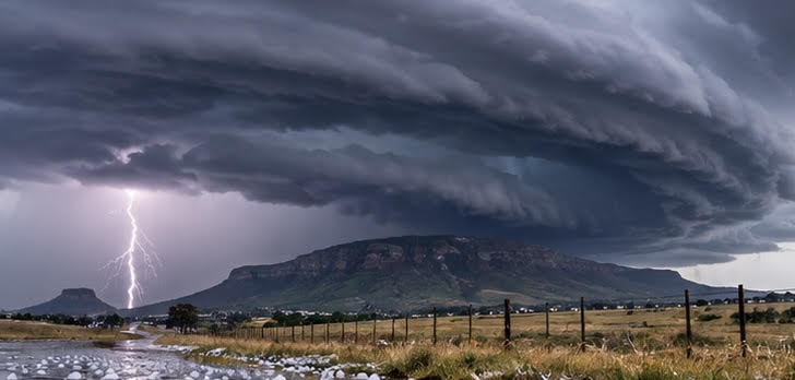
Severe Storms Target South Africa as Hail and Flooding Threats Increase
Parts of South Africa are facing a potentially dangerous round of severe thunderstorms, with heavy rainfall, large hail, frequent lightning and damaging winds among the primary concerns.
A Yellow Level 4 severe-weather warning has highlighted areas including KwaZulu-Natal, Gauteng and Mpumalanga.
Some storms could produce intense rainfall in a short period of time, increasing the potential for localized flash flooding, especially in urban communities and low-lying areas.
Hail and powerful wind gusts could also damage vehicles, homes, crops and infrastructure. Frequent lightning presents an additional danger for anyone caught outdoors.
The developing storm pattern is particularly concerning because multiple rounds of thunderstorms could bring additional rainfall to locations that have already experienced wet conditions.
Residents are being encouraged to secure outdoor belongings, seek shelter when thunderstorms approach and avoid driving through flooded roads.
South Africa’s severe-weather season is underway, and the coming days will be important as forecasters monitor the potential for additional thunderstorms across the region.
Keywords: South Africa severe weather, South Africa thunderstorms, KwaZulu-Natal storms, Gauteng weather, Mpumalanga flooding, large hail, damaging winds, flash flooding, African weather.
Hashtags: #SouthAfricaWeather #SevereStorms #LargeHail #FlashFlooding #KwaZuluNatal #Gauteng #Mpumalanga #Thunderstorms #AfricanWeather #BreakingWeather

Saudi Arabia Braces for Widespread Thunderstorms and Dangerous Flash Flooding
A developing period of unsettled weather is putting parts of Saudi Arabia on alert, with thunderstorms, heavy rainfall, hail and strong winds expected to affect multiple regions.
Weather warnings covering November 6 through November 10 are raising concerns about potentially dangerous flash flooding, particularly in areas where intense rainfall can quickly overwhelm normally dry waterways and desert drainage channels.
Some of the greatest concerns involve valleys and low-lying terrain, where water can rush through dry riverbeds with little warning.
Thunderstorms may also produce damaging wind gusts, reduced visibility and localized hail. Urban areas could experience street flooding when heavy rainfall overwhelms drainage systems.
Authorities are urging residents to remain alert, avoid flooded roads and stay away from wadis during periods of heavy rain.
Saudi Arabia’s desert environment can make these storms particularly dangerous. Areas that normally experience little rainfall can quickly become hazardous when intense thunderstorms develop.
The coming days will be important as forecasters monitor the movement and intensity of these storm systems.
Keywords: Saudi Arabia weather, Saudi Arabia thunderstorms, flash flooding, heavy rainfall, desert flooding, hailstorms, severe weather, November weather alerts, Middle East storms.
Hashtags: #SaudiArabia #SaudiWeather #FlashFlooding #Thunderstorms #MiddleEastWeather #FloodWarning #SevereWeather #HeavyRain #BreakingWeather
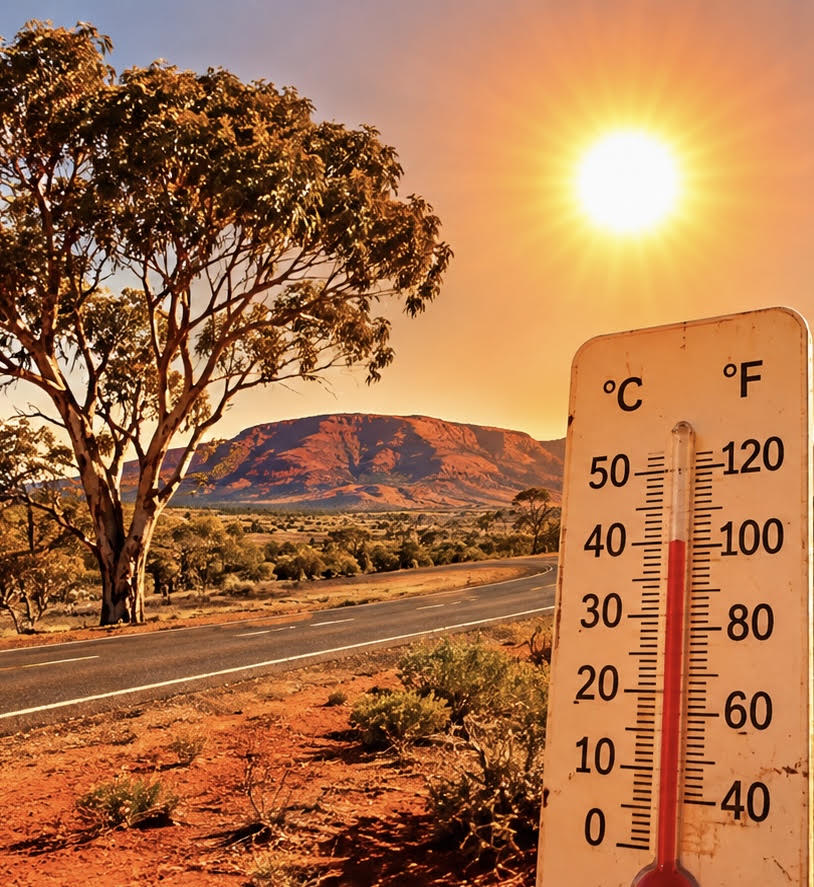
Australia Faces Dangerous Heat as River Flooding Threatens Communities
Australia is facing a dangerous combination of extreme heat and rising floodwaters, creating two very different weather threats across the country.
In Western Australia, an intense heat episode is bringing temperatures into the 104–113°F range (40–45°C) across parts of the Kimberley region. The extreme conditions are raising concerns about heat-related illnesses, dehydration and dangerous outdoor conditions.
Meanwhile, parts of Queensland are dealing with elevated river levels. Moderate flooding along sections of the Warrego River is creating concerns for rural communities, agricultural land and low-lying roads.
The combination of extreme heat in the west and flooding in the east highlights the country’s challenging weather pattern as November progresses.
Residents are being urged to follow local weather warnings, limit strenuous outdoor activity during peak heat and avoid crossing flooded roads.
Australia’s weather extremes are a reminder that dangerous conditions can develop simultaneously across different parts of a continent.
Keywords: Australia extreme heat, Western Australia heatwave, Kimberley temperatures, Queensland flooding, Warrego River, Australian weather, extreme temperatures, river flooding.
Hashtags: #AustraliaWeather #ExtremeHeat #Heatwave #QueenslandFlooding #WarregoRiver #FloodWarning #WeatherNews #BreakingWeather #ClimateExtremes

Polar vortex splitting in two could open the door for Arctic air outbreaks
An unusual atmospheric disturbance high above the Arctic is raising concerns among meteorologists as the polar vortex begins stretching and splitting into two separate areas.
Forecast models indicate that an unusually early disruption of the polar vortex could develop during the first part of November. Meteorologists are watching closely because the event could potentially influence winter weather across North America and Europe in the weeks ahead.
The polar vortex is a massive circulation of cold air that normally spins around the Arctic during the colder months. When it is strong and stable, much of the coldest air tends to remain concentrated near the polar region.
However, the developing disturbance is associated with a phenomenon called sudden stratospheric warming. This occurs when temperatures in the stratosphere rise dramatically, weakening the powerful winds that normally surround the polar vortex.
In some cases, the vortex can become displaced or split into two separate lobes. This can disrupt the atmospheric circulation and increase the possibility of Arctic air moving farther south into populated areas.
Some meteorologists are watching for potential temperature changes in late November and December, although the timing and strength of any impacts remain uncertain.
There is another major factor complicating this winter’s forecast: the developing Super El Niño.
El Niño is expected to favor warmer-than-average conditions across much of the northern United States, potentially competing with the atmospheric changes associated with the polar vortex disruption.
That means an early polar vortex split does not automatically translate into a major winter storm or widespread Arctic outbreak.
Meteorologists will be monitoring atmospheric temperatures, wind reversals and changes in the jet stream to determine whether this unusual event eventually produces significant impacts at the surface.
The bottom line: An exceptionally early polar vortex disruption could make the coming winter more unpredictable. The big question is whether the atmospheric disturbance will eventually send Arctic air into the United States or remain largely confined to higher levels of the atmosphere.
Sources: NOAA meteorologists, USA Today weather reporting, FOX Weather and DTN meteorological analysis.
Keywords
Polar vortex, polar vortex split, sudden stratospheric warming, Arctic air outbreak, November 2026 weather, winter 2026–2027, Arctic cold, jet stream disruption, stratosphere, extreme winter weather, Super El Niño, North America winter forecast.
Hashtags
#PolarVortex #PolarVortexSplit #ArcticBlast #SuddenStratosphericWarming #WinterWeather #WeatherNews #ExtremeWeather #ArcticAir #JetStream #SuperElNino #Winter2026 #WeatherForecast
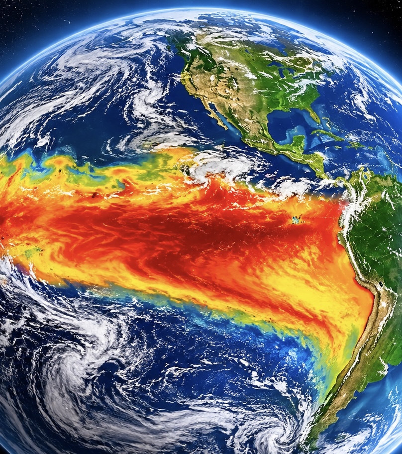
Powerful El Niño could reshape global weather this winter
A powerful El Niño is strengthening across the Pacific Ocean, and meteorologists warn that it could dramatically influence weather patterns around the world during the winter of 2026–2027.
According to NOAA’s October 15 outlook, this developing El Niño is expected to remain influential through the winter and into spring 2027. Ocean temperatures across the equatorial Pacific are significantly warmer than normal, helping shift major atmospheric circulation patterns.
For the United States, the developing pattern could bring warmer-than-average temperatures across much of the northern part of the country, while increasing the potential for wetter conditions across the southern states, Southwest and East Coast.
The shifting jet stream could also create more opportunities for powerful Pacific storms to move across the southern United States. Repeated rounds of heavy rainfall could increase flooding and mudslide risks, particularly in areas already experiencing saturated soil.
Internationally, El Niño can influence rainfall patterns across Australia, Southeast Asia, India, Africa and South America. Some regions may experience prolonged drought, while others face increased rainfall and flooding.
One of the biggest concerns is the potential for extreme weather to develop in places that are already vulnerable to drought, flooding or agricultural disruption.
Although El Niño does not guarantee specific storms or disasters, its growing strength makes it one of the most important climate factors meteorologists will be watching this winter.
The bottom line: This could be an unusually influential winter, with major shifts in temperature, rainfall and storm tracks across multiple continents.
Sources: NOAA Winter Outlook and Climate Prediction Center.
Keywords
El Niño 2026, Super El Niño, winter weather forecast, Pacific Ocean warming, global weather patterns, jet stream, extreme weather, winter storms, drought, flooding, NOAA winter outlook, climate patterns, 2027 weather forecast.
Hashtags
#ElNino #SuperElNino #WeatherNews #WinterWeather #GlobalWeather #ExtremeWeather #ClimateWatch #NOAA #Flooding #Drought #JetStream #WeatherForecast #2027Weather
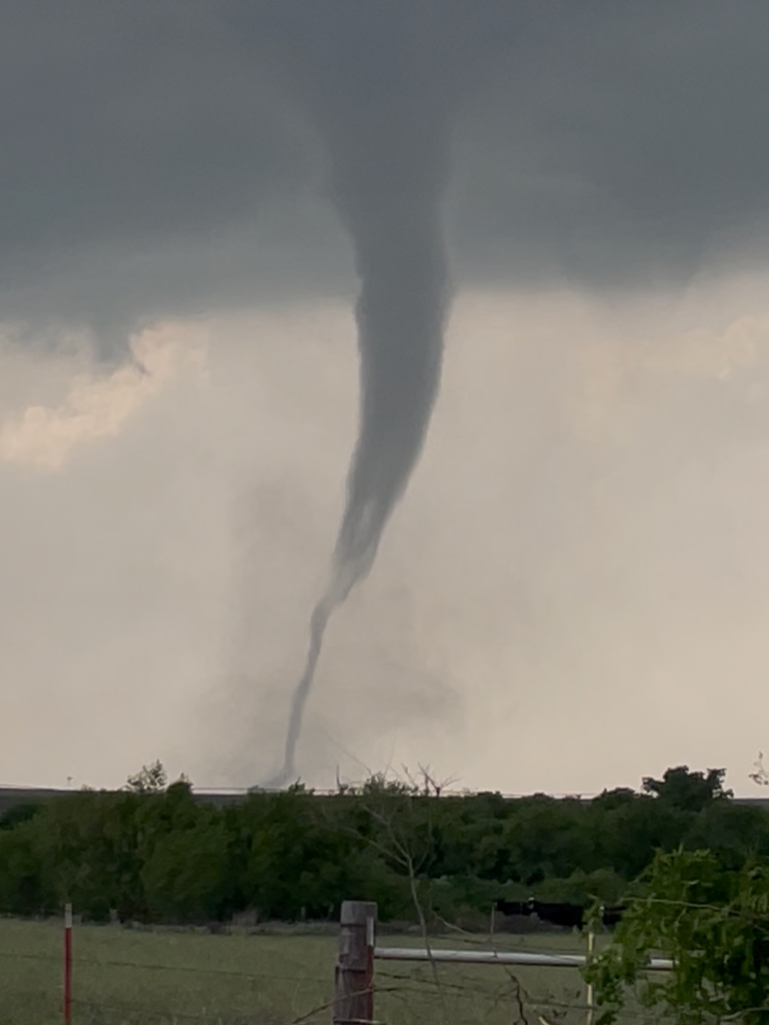
Severe Storms Could Bring Tornadoes, Large Hail and Damaging Winds to Oklahoma, Texas and Kansas
A developing storm system is expected to bring another round of severe weather to the central and southern Plains on Monday, November 2, with Oklahoma, northern Texas and parts of Kansas facing the potential for dangerous thunderstorms.
The National Weather Service Storm Prediction Center has outlined a Slight Risk of severe thunderstorms across portions of the region.
Forecasters expect thunderstorms to develop during the afternoon and become more widespread into the evening as a powerful upper-level storm system moves across the Plains.
The primary threats include damaging straight-line winds, large hail and a few tornadoes. Some storms could develop into rotating supercells capable of producing tornadoes before merging into larger lines of thunderstorms.
Oklahoma is an area of particular interest as atmospheric conditions could become favorable for rotating storms, especially if sufficient daytime heating develops. Parts of western and northern Oklahoma could see initial storm development, with additional storms potentially moving eastward through the evening.
Northern Texas is also expected to experience strong thunderstorms, with some storms capable of producing damaging winds, large hail and isolated tornadoes.
Kansas could see severe thunderstorms as the system moves northeastward. Storms may eventually organize into larger lines, creating additional damaging-wind concerns.
The severe weather threat could continue into the overnight hours, making nighttime preparedness especially important.
Residents across the Plains should have multiple ways to receive weather warnings, keep phones charged and identify a safe shelter before storms arrive.
Remember, tornadoes can develop quickly, including after dark. Do not wait until a tornado warning is issued to identify where you will take shelter.
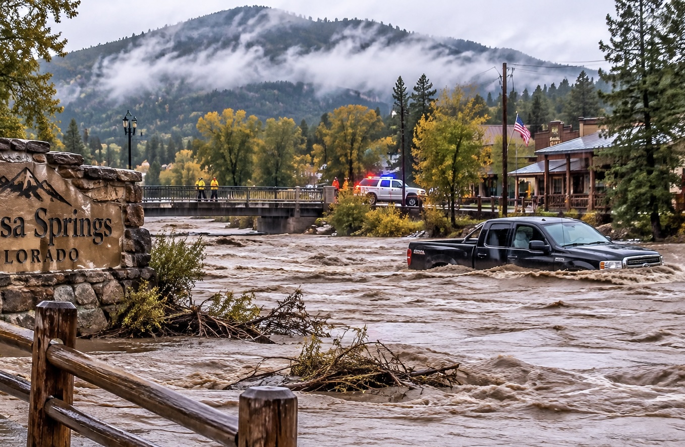
Potentially Catastrophic Flooding Threatens Communities Across the Southwest
Heavy rainfall is creating dangerous flooding across parts of Arizona, New Mexico and Colorado, forcing evacuations, closing roads and putting entire communities on alert.
One of the most serious situations is unfolding in Pagosa Springs, Colorado, where the San Juan River has threatened to reach levels exceeding the historic flood of 1911. Emergency officials warned that the river could reach approximately 22 feet, potentially causing extensive damage to homes, businesses and infrastructure.
Mandatory evacuations were ordered for vulnerable neighborhoods, particularly properties near the San Juan River and other low-lying waterways. Highway restrictions and road closures have also complicated travel into the mountain community.
Arizona is experiencing significant flooding as well. In Sedona, rapidly rising Oak Creek trapped residents inside their homes, prompting emergency rescues. Other communities, including Camp Verde, Flagstaff and Tucson, have also experienced dangerous flooding and overwhelmed drainage systems.
The threat extends into northern New Mexico and the Four Corners region, where already saturated ground is increasing the potential for additional runoff and flash flooding.
Forecasters warn that additional rainfall could worsen conditions through Monday. Floodwaters can rise quickly, even in areas where rainfall has stopped.
Residents are being urged to follow evacuation orders, avoid flooded roadways and never attempt to drive through moving water.
This is a developing emergency, and additional flooding and infrastructure damage remain serious concerns.
SEO Keywords
Southwest flooding November 2026
Arizona flash flooding
Colorado historic flooding
Pagosa Springs San Juan River
New Mexico flood warnings
Sedona Arizona flooding
Four Corners flood emergency
Heavy rainfall and flash floods
Mandatory evacuations Colorado
Dangerous river floodingHashtags
#BreakingWeather #SouthwestFlooding #ArizonaFlooding #ColoradoFlooding #NewMexicoWeather #PagosaSprings #SanJuanRiver #FlashFlooding #FloodEmergency #WeatherNews #ExtremeWeather #FloodWatch
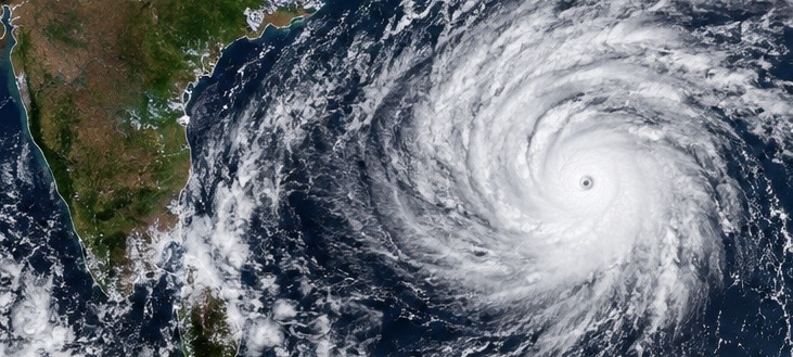
Cyclone Arnab slams India’s eastern coast, leaving flooding and destruction
ANDHRA PRADESH, INDIA — A powerful tropical cyclone has slammed into India’s eastern coastline, bringing destructive winds, torrential rainfall and widespread disruption.
Cyclone Arnab made landfall along the coast of Andhra Pradesh after strengthening over the Bay of Bengal. The storm brought sustained winds estimated at 125 to 135 kilometers per hour, with stronger gusts reaching approximately 150 kilometers per hour.
Authorities reported damage to homes, roads, electrical infrastructure and agricultural crops. More than 180,000 people were evacuated across Andhra Pradesh and neighboring Odisha as emergency crews worked to move residents away from dangerous coastal and low-lying areas.
Heavy rainfall has also affected transportation, with numerous trains canceled or rescheduled and airport operations disrupted.
Although the cyclone is expected to weaken as it moves inland, flooding remains a concern as heavy rainfall continues across parts of eastern India.
Emergency response teams are assessing the damage and assisting affected communities.
Sources: Reuters and India’s Akashvani News, October 28. Reuters +1
Keywords: Cyclone Arnab, India cyclone, Andhra Pradesh, Bay of Bengal, India flooding, tropical cyclone, storm surge, evacuation, extreme rainfall, Odisha.
Hashtags:
#CycloneArnab #IndiaWeather #IndiaFlooding #AndhraPradesh #BayOfBengal #TropicalCyclone #ExtremeWeather #WeatherNews #StormCoverage #BreakingWeather
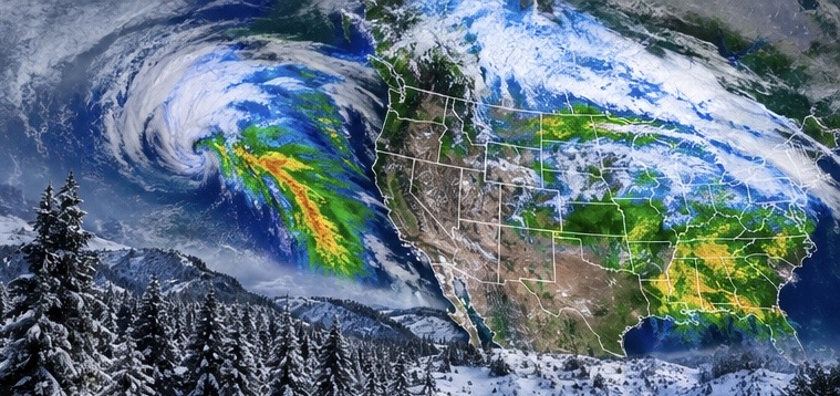
Massive U.S. storm threatens 35 states with flooding, severe weather and snow
UNITED STATES — A sprawling storm system is setting up to bring a wide range of dangerous weather across the United States as November begins.
Forecasts indicate the developing system could affect as many as 35 states, bringing heavy rainfall, thunderstorms, possible flash flooding and significant mountain snowfall.
The storm is expected to begin affecting the Southwest and western United States before progressing eastward across the country.
Parts of California and the Desert Southwest could experience periods of heavy rainfall, while higher elevations face accumulating snow. As the system moves toward the central United States, additional rounds of rain and thunderstorms are expected.
The National Weather Service’s Weather Prediction Center is highlighting continued heavy rainfall across portions of the Plains on Friday, October 30, with localized flash flooding possible.
The storm’s progression could create changing travel conditions, including flooded roadways, reduced visibility and hazardous mountain passes.
Residents across the affected regions should monitor local forecasts as the system develops.
Keywords: United States storm, 35 states, cross-country storm, severe weather, flash flooding, Southwest storms, California rainfall, mountain snow, Plains thunderstorms, November weather.
Hashtags:
#USWeather #SevereWeather #StormSystem #FlashFlooding #WeatherAlert #CaliforniaWeather #SouthwestWeather #WinterStorm #HeavyRain #WeatherNews
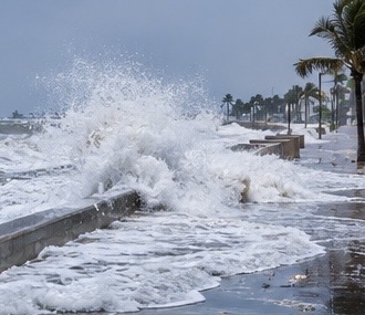
Record-breaking king tides send seawater flooding into U.S. coastal communities
UNITED STATES — Exceptionally high tides are sending seawater into coastal communities across California and Florida, flooding streets, threatening homes and disrupting transportation.
The unusual coastal flooding is being driven by a combination of king tides and persistent onshore winds pushing ocean water farther inland.
In Florida, water levels at Port Canaveral reached approximately 3.02 feet above Mean Higher High Water, setting a record for the highest non-tropical water level recorded at that station since monitoring began in 1994.
Along the California coastline, rising seawater has inundated roadways, with flooding forcing the closure of portions of Pacific Coast Highway near Huntington Beach.
Other coastal communities have reported flooded streets, water entering residential areas and beach erosion.
King tides are naturally occurring exceptionally high tides caused by the gravitational relationship between Earth, the Moon and the Sun. However, strong coastal winds and elevated ocean levels can make their impacts much worse.
Although tides are expected to gradually decrease, additional high tides and persistent coastal winds could keep flooding concerns alive into the coming days.
Sources: ClickOrlando and The Weather Channel, October 29. WKMG +1
Keywords: King tides, coastal flooding, California flooding, Florida flooding, Pacific Coast Highway, Port Canaveral, Huntington Beach, ocean surge, coastal erosion, high tides.
Hashtags:
#KingTides #CoastalFlooding #CaliforniaWeather #FloridaWeather #OceanFlooding #CoastalErosion #PacificCoast #ExtremeWeather #Flooding #WeatherNews
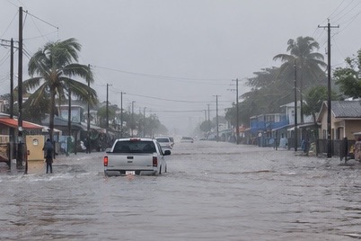
Extreme rainfall overwhelms Ecuador as flooding spreads across South America
ECUADOR AND PERU — Torrential rainfall is creating dangerous flooding conditions across parts of western South America, with Ecuador experiencing particularly intense rainfall and widespread urban flooding.
In Ecuador, heavy downpours have overwhelmed drainage systems and caused rivers to overflow, flooding homes, streets and transportation routes.
Guayaquil has experienced some of the most significant impacts. October rainfall has been unusually intense, with measurements from local monitoring stations showing exceptionally high accumulations.
According to measurements reported by ESPOL, Guayaquil received an average of approximately 216 millimeters of rainfall on October 19 alone. That made October one of the city’s wettest months in records dating back to 1950.
Flooding has also affected communities in Guayas, El Oro and Manabí provinces, with families forced to evacuate and roads becoming impassable.
Across neighboring Peru, the broader regional weather pattern associated with El Niño is raising concerns about additional heavy rainfall and flooding. However, the extent of current impacts varies by region, and additional country-specific warnings should be checked before reporting specific damage there.
Meteorologists are watching the developing climate pattern closely as unusually warm Pacific Ocean conditions can influence rainfall across western South America.
Sources: Pan American Health Organization, October 26, and Primicias/ESPOL, October 19. Pan American Health Organization +1
Keywords: Ecuador flooding, Peru weather, Guayaquil rainfall, El Niño, South America flooding, extreme rainfall, overflowing rivers, urban flooding, Pacific Ocean temperatures, climate patterns.
Hashtags:
#EcuadorFlooding #PeruWeather #SouthAmericaWeather #Guayaquil #ElNino #ExtremeRainfall #Flooding #ClimateWatch #WeatherDisaster #WorldWeather
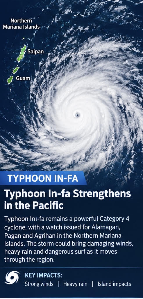
Super Typhoon In-fa strengthens as it tracks toward the Northern Mariana Islands
October 28, 2026 | Western Pacific Ocean
A powerful Typhoon In-fa is strengthening over the western Pacific as it moves west-northwest toward the far northern Mariana Islands. The U.S. National Weather Service reported maximum sustained winds of approximately 130 mph Wednesday morning, making In-fa a Category 4-equivalent typhoon.
Forecasters expect the storm to maintain its powerful intensity and potentially strengthen further. A typhoon watch has been issued for Alamagan, Pagan and Agrihan, where damaging winds and dangerous weather conditions could develop. The storm is expected to turn northwest toward the northern Mariana Islands later this week.
Heavy rain, destructive winds and dangerous seas could threaten island communities and disrupt marine and air travel. Residents should monitor official advisories as the storm’s track and intensity continue to evolve.
Keywords: Typhoon In-fa, Super Typhoon, Northern Mariana Islands, western Pacific, Category 4 typhoon, tropical cyclone, typhoon watch, damaging winds, dangerous seas, Pacific weather.
Hashtags:
#TyphoonInFa #SuperTyphoon #NorthernMarianaIslands #PacificStorm #Typhoon #TropicalCyclone #SevereWeather #WeatherNews #BreakingWeather #StormChasing
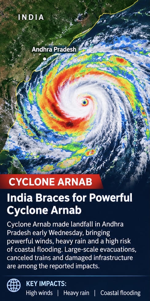
Cyclone Arnab slams India’s east coast, bringing flooding and destruction
NEW DELHI, INDIA — October 26, 2026
The India Meteorological Department (IMD) reported that a deep depression was located over the east-central and adjoining southeastern Bay of Bengal on Sunday. Forecasters expect the system to strengthen into a cyclonic storm on October 26, with further intensification possible.
If it develops into a named cyclone, the storm will be called Cyclone Arnab.
The storm is forecast to move generally west-northwestward toward the coast, placing parts of Andhra Pradesh and southern Odisha under heightened watch. Current forecasts indicate that the system could approach or cross the north Andhra Pradesh coast around October 28, although its exact track and intensity may change.
Heavy rainfall is a major concern. Forecasts warn of heavy to extremely heavy rain in parts of coastal Andhra Pradesh and Odisha on October 27 and 28. Torrential rainfall could cause flash flooding, waterlogged roads, river rises and landslides in vulnerable areas.
Strong winds and rough seas could also threaten fishing operations, shipping and coastal communities. Residents and people working at sea are being urged to follow official warnings and instructions from local authorities.
The storm’s final strength and landfall location remain uncertain. Even if its center stays offshore, outer rainbands could produce dangerous conditions across parts of the eastern coast.
Authorities are closely monitoring the system as it develops. Residents should prepare for possible travel disruptions, avoid entering floodwaters and pay attention to evacuation instructions if issued.
The bottom line: A deep depression is forecast to strengthen into a cyclone, with the greatest concerns focused on heavy rainfall, coastal winds and flooding in eastern India. The next official forecasts will be critical in determining the storm’s likely intensity and path.
SEO keywords
Whakaari volcano, White Island volcano, New Zealand volcano eruption, volcanic ash plume, GeoNet alert level 3, aviation colour code orange, Bay of Plenty volcano, New Zealand volcanic activity, volcanic ash aviation warning
Hashtags
#NewZealand #WhiteIsland #Whakaari #Volcano #VolcanicEruption #VolcanicAsh #GeoNet #BreakingWeather #WeatherNews #EarthScience
Cyclone Arnab has made landfall along India’s eastern coast, bringing powerful winds, torrential rain and flooding to parts of Andhra Pradesh. The storm struck early Wednesday with sustained winds reaching approximately 84 mph, damaging homes, toppling trees and disrupting electricity supplies.
Authorities evacuated residents from vulnerable coastal communities ahead of the storm, while flight and train services were disrupted. Storm surge and additional heavy rainfall threaten low-lying areas as Arnab weakens while moving inland. Heavy rain could also spread into neighboring states, creating further flood risks.
Emergency crews are assessing damage and clearing roads as residents face dangerous conditions. Officials continue to urge people to follow local warnings and stay away from flooded roads and coastal waters.
Keywords: Cyclone Arnab, India cyclone, Andhra Pradesh, Bay of Bengal, cyclone landfall, coastal flooding, extreme weather, storm damage, evacuation, heavy rainfall.
Hashtags:
#CycloneArnab #IndiaWeather #AndhraPradesh #Cyclone #ExtremeWeather #Flooding #WeatherNews #BreakingWeather #StormCoverage
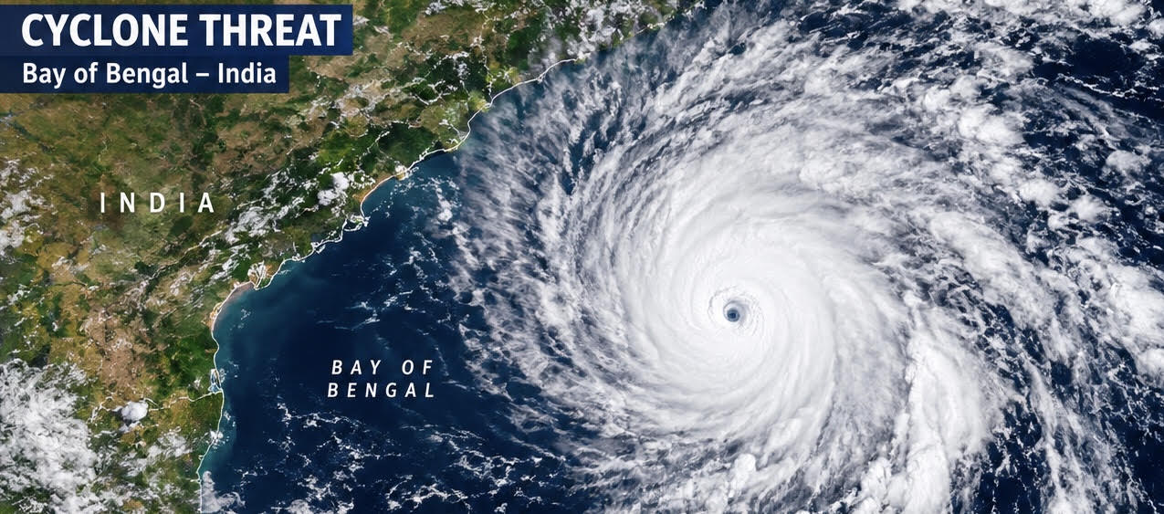
Bay of Bengal Cyclone Threatens India’s East Coast as Storm Intensifies
NEW DELHI, INDIA — October 26, 2026
A powerful weather system over the Bay of Bengal is strengthening and could bring dangerous winds and extremely heavy rainfall to India’s eastern coastline in the coming days.
The India Meteorological Department (IMD) reported that a deep depression was located over the east-central and adjoining southeastern Bay of Bengal on Sunday. Forecasters expect the system to strengthen into a cyclonic storm on October 26, with further intensification possible.
If it develops into a named cyclone, the storm will be called Cyclone Arnab.
The storm is forecast to move generally west-northwestward toward the coast, placing parts of Andhra Pradesh and southern Odisha under heightened watch. Current forecasts indicate that the system could approach or cross the north Andhra Pradesh coast around October 28, although its exact track and intensity may change.
Heavy rainfall is a major concern. Forecasts warn of heavy to extremely heavy rain in parts of coastal Andhra Pradesh and Odisha on October 27 and 28. Torrential rainfall could cause flash flooding, waterlogged roads, river rises and landslides in vulnerable areas.
Strong winds and rough seas could also threaten fishing operations, shipping and coastal communities. Residents and people working at sea are being urged to follow official warnings and instructions from local authorities.
The storm’s final strength and landfall location remain uncertain. Even if its center stays offshore, outer rainbands could produce dangerous conditions across parts of the eastern coast.
Authorities are closely monitoring the system as it develops. Residents should prepare for possible travel disruptions, avoid entering floodwaters and pay attention to evacuation instructions if issued.
The bottom line: A deep depression is forecast to strengthen into a cyclone, with the greatest concerns focused on heavy rainfall, coastal winds and flooding in eastern India. The next official forecasts will be critical in determining the storm’s likely intensity and path.
SEO keywords
Whakaari volcano, White Island volcano, New Zealand volcano eruption, volcanic ash plume, GeoNet alert level 3, aviation colour code orange, Bay of Plenty volcano, New Zealand volcanic activity, volcanic ash aviation warning
Hashtags
#NewZealand #WhiteIsland #Whakaari #Volcano #VolcanicEruption #VolcanicAsh #GeoNet #BreakingWeather #WeatherNews #EarthScience
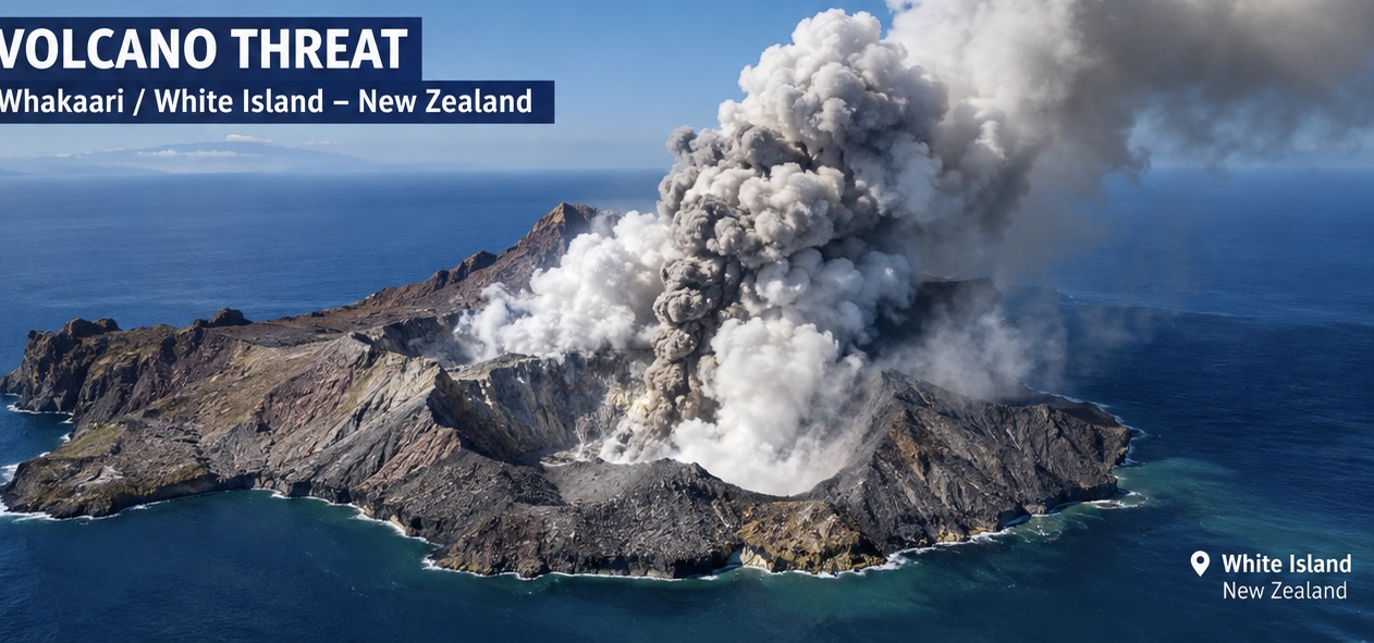
New Zealand Volcano Raises Alert as Ash Eruption Continues
WHĀKATĀNE, NEW ZEALAND — October 26, 2026
A volcano off New Zealand’s North Island is showing increased activity, prompting scientists to raise the volcanic alert level and warn that conditions could change with little notice.
Whakaari, also known as White Island, has been continuously releasing small amounts of volcanic ash as part of a low-level eruption. On October 21, New Zealand’s GeoNet monitoring service raised the Volcanic Alert Level to Level 3 and the Aviation Colour Code to Orange.
Scientists say the activity includes ash, steam and volcanic gases. Although the eruption is ongoing, authorities report no threat to mainland communities from the current activity. Light ash could reach nearby coastal areas under certain wind conditions, and residents may notice a sulfur smell.
The greater danger is close to the volcano. Officials warn that a more explosive event could occur suddenly, threatening the crater floor and nearby offshore waters.
The alert is also important for aviation because volcanic ash can pose a serious hazard to aircraft. An aviation advisory issued on October 25 reported a low-level ash plume extending eastward from the volcano.
Marine authorities have advised boats to remain at least two nautical miles from Whakaari because of the hazards around the island.
Whakaari lies about 50 kilometers offshore in the Bay of Plenty. Its remote location does not eliminate the danger to people approaching the island by boat or aircraft.
Scientists continue monitoring the volcano for changes in ash emissions, gas output and eruption intensity. Officials advise the public to follow updates from GeoNet and local emergency management authorities.
The bottom line: The volcano is experiencing a confirmed low-level eruption, but a major disaster on the mainland is not currently forecast. The principal immediate risks are close to the volcano, with aviation and marine hazards requiring continued attention.
SEO keywords
Whakaari volcano, White Island volcano, New Zealand volcano eruption, volcanic ash plume, GeoNet alert level 3, aviation colour code orange, Bay of Plenty volcano, New Zealand volcanic activity, volcanic ash aviation warning
Hashtags
#NewZealand #WhiteIsland #Whakaari #Volcano #VolcanicEruption #VolcanicAsh #GeoNet #BreakingWeather #WeatherNews #EarthScience
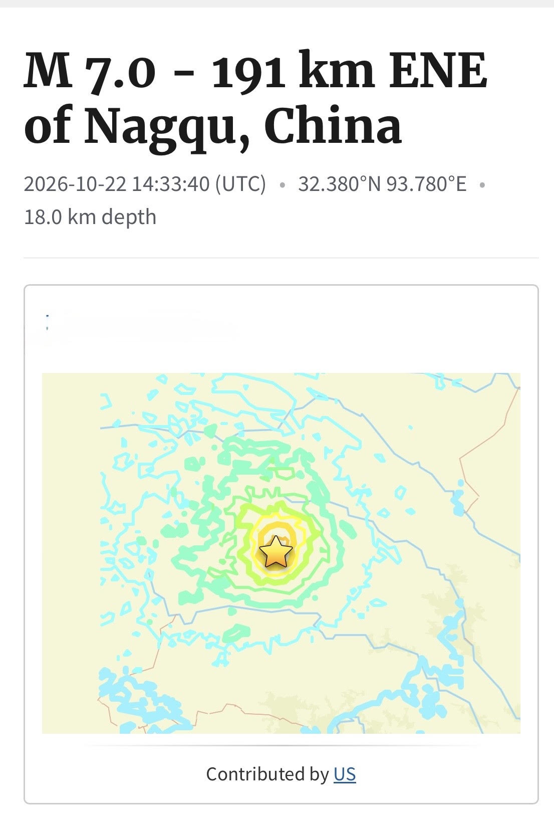
DEADLY QUAKE ROCKS CHINA. Powerful 7.0-Magnitude Earthquake Strikes Tibet, China; 16 Dead and Dozens Injured
DEADLY QUAKE ROCKS CHINA. Powerful 7.0-Magnitude Earthquake Strikes Tibet, China; 16 Dead and Dozens Injured
TIBET, CHINA — October 23, 2026
A powerful magnitude 7.0 earthquake struck a remote region of Tibet in southwestern China late Thursday night, killing at least 16 people and injuring dozens more. Rescue teams are searching damaged buildings as authorities work to assess the destruction and help residents displaced by the disaster. citeturn957357news4turn957357search1
The earthquake struck at approximately 10:33 p.m. local time on October 22 in Baqen County, within the Nagqu region of northern Tibet. The U.S. Geological Survey placed the epicenter about 191 kilometers (119 miles) east-northeast of Nagqu, at a depth of approximately 18 kilometers (11 miles). citeturn957357search1turn957357news19
Hundreds of Homes Damaged as Rescue Efforts Continue
Officials reported that at least 339 homes collapsed or were damaged. The latest reports put the number of injured at 76, including 11 people in serious condition. More than 12,000 residents have been relocated to safer areas as emergency crews respond to the disaster. citeturn957357news4turn957357news9
Video released by Chinese state media showed residents rushing outdoors as the ground shook, while emergency workers used flashlights to inspect damaged buildings and search affected communities.
Authorities are warning that buildings weakened by the initial earthquake could collapse during aftershocks. The earthquake also triggered rockfalls that forced the closure of part of a major highway, complicating access for rescue crews. citeturn957357search1turn957357news4
High Elevation and Cold Weather Complicate Response
The earthquake hit a remote, mountainous area of Tibet, where elevations approach 16,000 feet. The region’s rugged terrain, cold temperatures and forecast snowfall could make rescue and recovery operations more difficult.
Emergency personnel are delivering tents, temporary shelters, winter clothing and other essential supplies to people forced from their homes. Chinese President Xi Jinping has called for an all-out effort to rescue survivors and provide medical treatment to the injured. citeturn957357search1turn957357search13
Aftershocks Remain a Concern
Several smaller earthquakes have followed the main shock. Officials continue to assess damage and monitor the affected region as rescue and relief operations move forward.
The disaster is a reminder of the dangers earthquakes pose in China’s mountainous western regions. In January 2025, a major earthquake in Tibet’s Tingri County killed at least 126 people.
The latest confirmed toll stands at 16 dead and 76 injured, with further damage assessments and emergency operations continuing. citeturn957357news4turn957357search10
Reporting based on Reuters, Associated Press and official Chinese government reports. Figures may change as authorities release further updates.
SEO keywords
China earthquake, Tibet earthquake October 2026, magnitude 7.0 earthquake, Nagqu earthquake, Baqen County earthquake, China earthquake death toll, Tibet rescue operations, earthquake damage, aftershocks in China, international breaking news.
Hashtags
#ChinaEarthquake #TibetEarthquake #BreakingNews #Earthquake #NaturalDisaster #Nagqu #ChinaNews #RescueOperations #WorldNews #EarthquakeUpdate
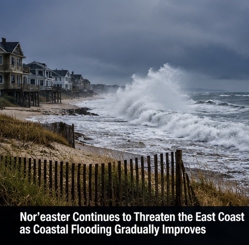
Nor’easter Keeps East Coast on Alert as Rough Seas and Coastal Hazards Continue
MID-ATLANTIC • NORTHEAST • COASTAL HAZARDS
An offshore nor’easter could continue affecting portions of the Mid-Atlantic and Northeast, keeping coastal communities on alert for rough seas, strong onshore winds and lingering coastal flooding concerns. Even as some locations begin to recover from earlier high water, the storm may continue producing hazardous conditions along exposed beaches and shorelines.
Nor’easters develop when strong low-pressure systems interact with colder air and winds blowing from the northeast across the Atlantic coast. Depending on the storm’s track and strength, these systems can generate large waves, beach erosion, dangerous surf and water pushed toward the coastline.
Coastal flooding does not affect every community equally. Local geography, tide levels, wind direction and the timing of high tide can all influence how much water reaches roads, parking areas and waterfront neighborhoods. Some locations may see improving conditions while others continue to experience hazardous surf or localized flooding.
The storm can also create dangerous conditions for boaters and other people on the water. Large waves and strong winds may make navigation difficult, while beach erosion can undermine dunes, walkways and sections of shoreline.
Residents should continue monitoring local coastal flood advisories and marine warnings. Beachgoers should avoid dangerous surf, and boaters should check conditions before heading out. Improving weather in one location does not necessarily mean the entire coastline is safe.
What to watch: Coastal flood advisories, high-tide forecasts, wave heights, beach erosion, wind speeds, marine warnings and the storm’s movement farther offshore.
Keywords: nor’easter, East Coast storm, Northeast weather, Mid-Atlantic weather, coastal flooding, beach erosion, dangerous surf, strong onshore winds, marine weather, Atlantic storm.
Hashtags: #Noreaster #EastCoastWeather #CoastalFlooding #NortheastWeather #AtlanticStorm #BeachErosion #MarineWeather #CoastalHazards #WeatherUpdate #StormNews
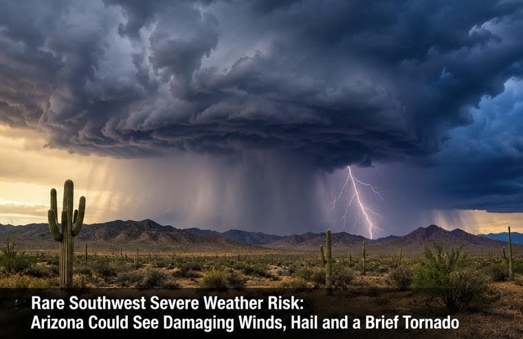
Rare Southwest Severe Weather Setup Could Bring Damaging Winds and Hail to Arizona and New Mexico
ARIZONA • NEW MEXICO • SEVERE THUNDERSTORMS
A developing storm system over the Southwest could create an unusual opportunity for severe thunderstorms across parts of Arizona and western New Mexico. The region is better known for intense summer monsoon storms, but changing upper-level weather patterns can also produce strong thunderstorms outside the traditional monsoon season.
As the upper-level system moves through the region, changing winds and atmospheric instability could help some thunderstorms become stronger than ordinary rain showers. Depending on how much moisture and instability are available, the strongest storms could produce damaging wind gusts, hail and locally intense rainfall.
A brief tornado is a possibility only if storms develop the necessary combination of rotation, instability and favorable wind conditions. That possibility should not be confused with a confirmed tornado forecast for every community in the region. Residents should follow updated Storm Prediction Center outlooks and local National Weather Service warnings for the specific threat in their area.
Heavy downpours could also create flash-flooding problems. Dry desert terrain, narrow canyons and normally dry washes can channel runoff rapidly, sometimes sending water into areas where rain has barely fallen. A storm several miles upstream can create dangerous conditions downstream.
People outdoors should have a way to receive weather warnings and should move indoors when thunderstorms approach. Hikers, campers and motorists crossing desert washes need to be especially cautious.
What to watch: Severe thunderstorm outlooks, damaging wind reports, hail, radar-indicated storm rotation, flash-flood warnings and any confirmed tornado reports.
Keywords: Arizona severe weather, New Mexico thunderstorms, Southwest storm system, damaging winds, large hail, tornado risk, upper-level disturbance, desert flash flooding, severe thunderstorm forecast, weather alerts.
Hashtags: #ArizonaWeather #NewMexicoWeather #SevereThunderstorms #TornadoRisk #DamagingWinds #HailStorm #FlashFlooding #SouthwestWeather #WeatherForecast #StormChasing
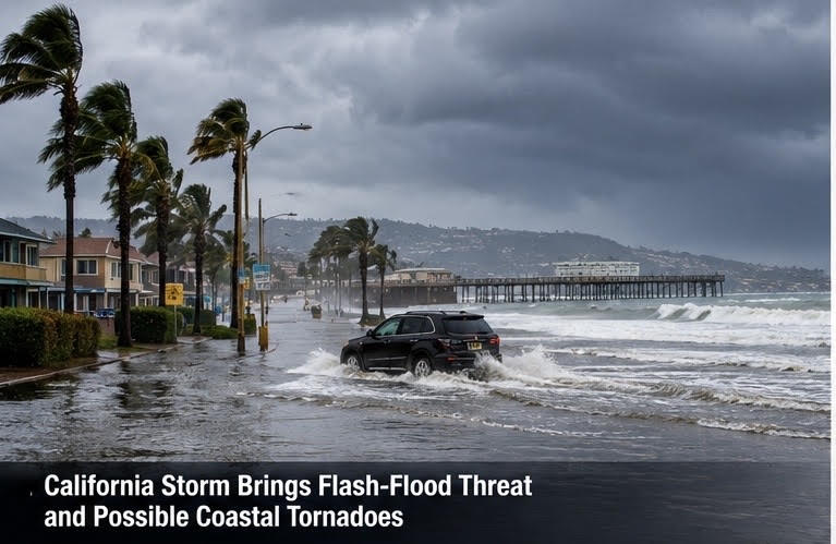
California Braces for Heavy Rain, Flash Flooding and Possible Coastal Tornadoes
CALIFORNIA • FLOODING • SEVERE WEATHER
Central and Southern California could face another round of wet and unsettled weather as a Pacific storm brings heavy rain and the potential for dangerous flooding. While the rain may help ease dry conditions in some areas, intense downpours can quickly create hazardous situations, especially in communities where recent wildfires have left hillsides vulnerable to erosion.
Burn scars are a major concern during heavy rainfall. When vegetation is destroyed by wildfire, the ground may have difficulty absorbing water. Rain can rush downhill, carrying mud, rocks, ash and debris into neighborhoods, roadways and drainage channels. Even a relatively short period of intense rain can trigger dangerous runoff, particularly in steep terrain.
Coastal areas also need to monitor changing conditions. Strong thunderstorms developing over or near the Pacific could bring locally heavy rain, gusty winds and dangerous marine conditions. If rotating storms develop, isolated waterspouts or brief tornadoes could be possible. These threats would depend on the storm’s actual structure and the atmospheric conditions at the time.
Drivers should be alert for water-covered roads, debris and sudden changes in visibility. People living near steep hillsides, burn scars and flood-prone areas should pay close attention to official weather alerts. Never drive through floodwater, even when the road appears passable.
What to watch: Rainfall rates, flash-flood warnings, debris flows near burn scars, coastal storm development and any new severe-weather alerts.
Keywords: California weather, Southern California rain, Central California storms, flash flooding, wildfire burn scars, debris flows, Pacific storm, coastal tornado risk, waterspouts, severe weather, flood safety.
Hashtags: #CaliforniaWeather #FlashFlooding #SevereWeather #FloodRisk #PacificStorm #SouthernCalifornia #WeatherNews #StormWatch #FloodSafety #BreakingWeather
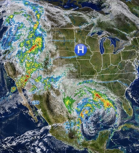
Quiet severe-weather outlook across much of the United States
The Storm Prediction Center’s October 18 outlook says severe thunderstorms are not expected Monday. A ridge of high pressure should maintain stable conditions across much of the central and eastern U.S., although isolated non-severe storms remain possible in parts of the Southwest.
Keywords: U.S. weather forecast, national weather outlook, severe weather forecast, Storm Prediction Center, October weather, autumn temperatures, high-pressure system, stable weather pattern, national storm outlook, Monday forecast, U.S. weather update.
Hashtags: #USWeather #NationalWeather #WeatherForecast #SevereWeather #StormPredictionCenter #AutumnWeather #WeatherUpdate #WeatherNews #MondayForecast #JazzBishop
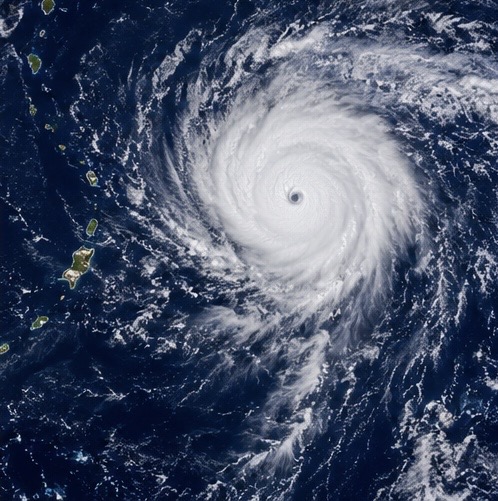
Super Typhoon Champi near Guam
Powerful typhoon moves into the Philippine Sea
Champi is another international story worth monitoring. AP reports that the typhoon passed near Guam and continued into the Philippine Sea, with dangerous winds and regional recovery concerns.
Keywords: Super Typhoon Champi, Guam weather, Western Pacific typhoon, Philippine Sea, tropical cyclone, typhoon satellite imagery, typhoon track, tropical storm forecast, Pacific typhoon season, dangerous winds, international weather news.
Hashtags: #TyphoonChampi #SuperTyphoon #Guam #WesternPacific #PhilippineSea #TropicalCyclone #TyphoonSeason #SatelliteImagery #BreakingWeather #WeatherNews #JazzBishop

Low-pressure system brings rain chances to California
A low-pressure system moving southward along the West Coast is forecast to develop scattered rain over parts of California through Tuesday. Follow the system’s track and any changes in rainfall forecasts.
Why it matters: A developing weather system to monitor as the forecast evolves
Keywords: California weather, California coastal storm, Pacific low-pressure system, West Coast rain, California rainfall forecast, Pacific storm system, changing weather pattern, coastal clouds, California weather update, West Coast forecast.
Hashtags: #CaliforniaWeather #WestCoastWeather #PacificStorm #CaliforniaRain #CoastalWeather #WeatherForecast #StormWatch #WeatherNews #BreakingWeather #JazzBishop
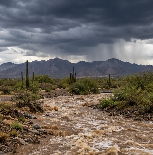
Heavy downpours could trigger flash flooding in Arizona and New Mexico
The Weather Prediction Center has identified a Marginal Risk of excessive rainfall in parts of southeastern Arizona and southwestern New Mexico for Monday. Localized rain rates of 1–2 inches per hour are possible, which could trigger isolated flash flooding.
Why it matters: Flash flooding can develop quickly, especially in dry washes and low-water crossings.
Keywords: Arizona flash flooding, New Mexico flooding, Southwest storms, excessive rainfall outlook, flash-flood risk, heavy downpours, desert flooding, dry washes, dangerous floodwaters, flood safety, Weather Prediction Center, Southwest weather forecast.
Hashtags: #FlashFlooding #ArizonaWeather #NewMexicoWeather #FloodThreat #SouthwestWeather #HeavyRain #FloodSafety #WeatherAlert #BreakingWeather #WeatherNews #JazzBishop
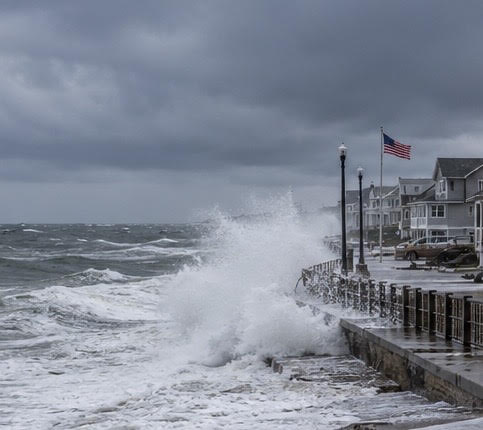
Nor’easter brings rain to parts of the Mid-Atlantic and Northeast
A coastal low is expected to produce rain showers along portions of the Mid-Atlantic and Northeast coast through Tuesday. Track local rainfall, wind conditions and coastal impacts.
Why it matters: A timely regional forecast with coastal radar and local impacts.
Keywords: Nor’easter, Northeast storm, Mid-Atlantic weather, New England rain, coastal storm, strong coastal winds, coastal flooding risk, autumn storm, Northeast forecast, Atlantic storm system, Monday weather forecast.
Hashtags: #Noreaster #NortheastWeather #NewEngland #MidAtlantic #CoastalStorm #RainForecast #WeatherAlert #WeatherNews #BreakingWeather #JazzBishop
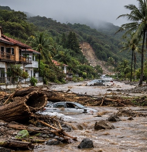
Hurricane Trudy’s aftermath: Flooding and landslides threaten Mexico
Hurricane Trudy brought strong winds and heavy rain to Mexico’s Pacific coast. Rainfall, flooding and mudslides remain the key concerns as the storm weakens. Some areas could receive up to 12 inches of rain.
Why it matters: A strong visual story with satellite imagery, rainfall totals and flood impacts.
Keywords: Hurricane Trudy, Mexico flooding, Pacific coast Mexico, tropical storm aftermath, hurricane damage, flash flooding Mexico, landslides, heavy rainfall, tropical cyclone, flood damage, Mexico weather news, storm recovery.
Hashtags: #HurricaneTrudy #Mexico #Flooding #Landslides #HurricaneSeason #TropicalWeather #WeatherNews #BreakingWeather #StormDamage #FloodRisk #JazzBishop
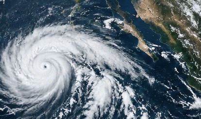
Repeated Downpours Raise Flash Flood Threat Across Texas and the Central Plains
Trudy was a Category 1 hurricane in Thursday’s reporting, with forecasts calling for major-hurricane strength Friday. Rainfall of 4–8 inches, with isolated totals near 12 inches, was forecast for parts of Colima and Jalisco through the weekend, raising dangerous flood and landslide concerns.Watch: Updated intensity, track, coastal warnings and land impacts.
HASHTAGS
#FlashFlooding #TexasWeather #SevereWeather #FloodWarning #HeavyRain #CentralPlains #FloodRisk #WeatherNews #StormChasing #JazzBishop
SEO KEYWORDS
flash flooding Texas, heavy rainfall Texas, Central Plains flooding, repeated downpours, flash flood threat, severe weather forecast, flood warnings, dangerous driving conditions, flooding updates, Texas weather news, Oklahoma weather, Jazz Bishop weather report
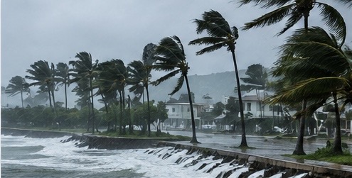
Tropical Storm Trudy Rapidly Intensifies in the Eastern Pacific
The Weather Prediction Center has highlighted excessive rainfall concerns across parts of the Southern Plains. Western Texas rain was expected to continue Friday morning, while flooding and river levels remain important to monitor in affected areas.
Watch: Flash-flood warnings, rainfall totals and rising rivers, including in Oklahoma
HASHTAGS
#TexasFlooding #FlashFlooding #OklahomaWeather #SouthernPlains #FloodWarning #HeavyRain #RisingRivers #FloodRisk #SevereWeather #WeatherNews #StormChasing #JazzBishop
SEO KEYWORDS
Texas flooding, Southern Plains flooding, flash flood warnings, heavy rainfall in Texas, western Texas rainfall, Oklahoma flooding, rising river levels, excessive rainfall outlook, flood threat forecast, Texas weather forecast, Southern Plains weather, flash flood risk, latest weather news
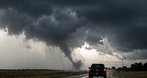
SEVERE STORMS COULD BRING DAMAGING WINDS AND TORNADOES TO MID ATLANTIC
The Storm Prediction Center has outlined a Slight Risk (Level 2 of 5) for parts of the Mid-Atlantic on Friday. Damaging wind gusts are the main concern, with a few brief tornadoes possible.
Watch: Updated SPC outlooks, storm timing and any watches issued Friday.
HASHTAGS
#ColdFront #MountainSnow #WinterWeather #RockyMountains #FreezingTemperatures #WesternWeather #WeatherForecast #SnowForecast #WeatherAlert #JazzBishop
SEO KEYWORDS
major cold front, Western United States weather, Rocky Mountains snow forecast, mountain snowfall, freezing temperatures forecast, early season winter weather, cold air outbreak, Western states weather forecast, temperature drop, snow in the Rockies, severe weather updates, Jazz Bishop weather report
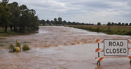
Flooding Threat Continues Across Texas and the Southern Plains
The Weather Prediction Center has highlighted excessive rainfall concerns across parts of the Southern Plains. Western Texas rain was expected to continue Friday morning, while flooding and river levels remain important to monitor in affected areas.
Watch: Flash-flood warnings, rainfall totals and rising rivers, including in Oklahoma
HASHTAGS
#TexasFlooding #FlashFlooding #OklahomaWeather #SouthernPlains #FloodWarning #HeavyRain #RisingRivers #FloodRisk #SevereWeather #WeatherNews #StormChasing #JazzBishop
SEO KEYWORDS
Texas flooding, Southern Plains flooding, flash flood warnings, heavy rainfall in Texas, western Texas rainfall, Oklahoma flooding, rising river levels, excessive rainfall outlook, flood threat forecast, Texas weather forecast, Southern Plains weather, flash flood risk, latest weather news
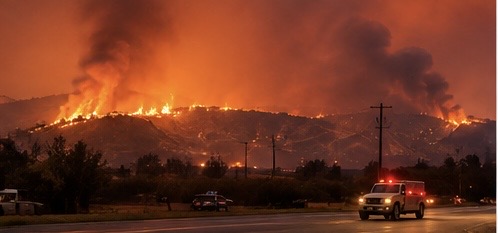
Dangerous Fire Weather and Santa Ana Winds Threaten CaliforniA
Hot, windy conditions have heightened wildfire concerns. Reports Thursday described Red Flag Warnings, precautionary power shutoffs and evacuations associated with brush fires. The reported threat was expected to continue through Saturday.
Watch: Red Flag Warnings, new fire starts, evacuation orders and power shutoffs.
HASHTAGS
#CaliforniaWildfires #SantaAnaWinds #FireWeather #RedFlagWarning #WildfireThreat #CaliforniaWeather #WildfireEvacuations #PowerShutoffs #BrushFire #WildfireNews #WeatherNews #JazzBishop
SEO KEYWORDS
California wildfire threat, Santa Ana winds, dangerous fire weather, California Red Flag Warnings, wildfire evacuation orders, California brush fires, wildfire power shutoffs, high winds in California, wildfire risk forecast, dry and windy conditions, California fire danger, latest wildfire news
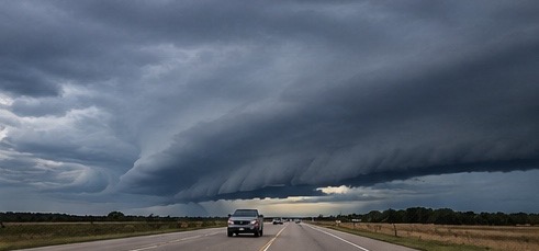
Powerful Cold Front Brings Wind and a Sharp Temperature Drop to Texas
A strong front is moving through Texas, bringing gusty northerly winds and cooler conditions. North and Central Texas could see gusts of 40–45 mph, with colder weekend temperatures following the front.
Watch: Wind advisories, first frost or freeze potential in the Panhandle and temperature changes across the state.
HASHTAGS
#TexasColdFront #TexasWeather #TemperatureDrop #StrongWinds #WindAdvisory #NorthTexasWeather #CentralTexasWeather #FirstFreeze #PanhandleWeather #WeatherForecast #SevereWeather #JazzBishop
SEO KEYWORDS
Texas cold front, Texas temperature drop, strong northerly winds, North Texas weather forecast, Central Texas weather, 40 to 45 mph wind gusts, Texas weekend forecast, Texas Panhandle freeze potential, first frost in Texas, cold weather in Texas, Texas wind advisories, fall cold front, latest Texas weather news
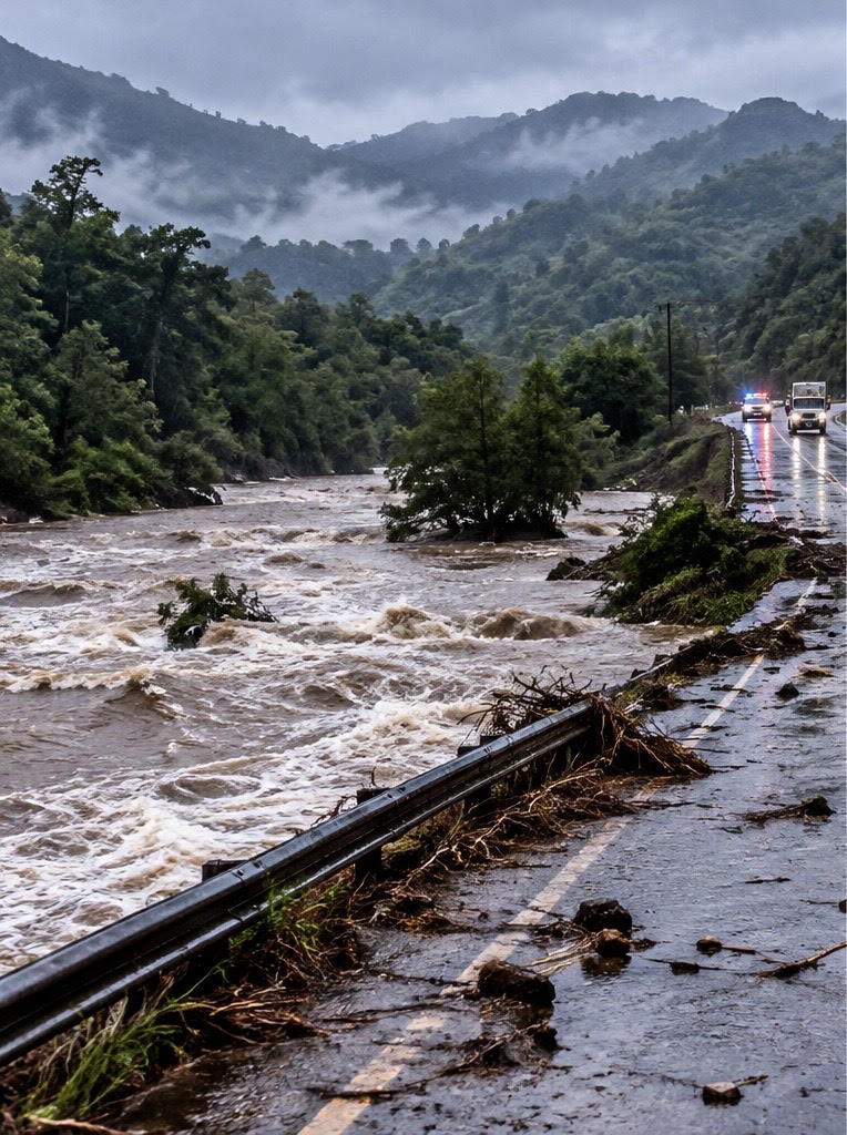
WEATHER: Cold Front Brings Mountain Snow, Freezing Temperatures and a Major Autumn Cooldown
DENVER, Colorado — October 14, 2026 — Winter is making an early appearance across parts of the Rocky Mountains as a powerful weather system brings mountain snow, chilly rain and freezing temperatures. Meanwhile, millions of Americans enjoying unusually warm autumn weather across the central and eastern United States could soon feel a dramatic change.
The National Weather Service Weather Prediction Center says unsettled weather is moving into the West, with rain, mixed precipitation and snow at higher elevations. A developing low-pressure system moving toward the Four Corners region is expected to bring another round of cold, unsettled conditions through the middle of the week.
Rocky Mountains Prepare for Snow and Freezing Temperatures
Colorado, Utah and Wyoming are among the states expecting mountain snowfall as colder air moves across the region.
The Weather Prediction Center reports that the highest elevations of the central Rockies could receive significant additional snowfall. In parts of Utah and Colorado above 10,000 feet, forecast probabilities favor at least 8 inches of additional snow, with locally higher totals possible in favored mountain ranges.
Snow levels are expected to fall as the system progresses, potentially bringing lighter accumulations to elevations around 6,500 to 7,000 feet in parts of the region.
The cold will also create concerns at lower elevations. Freeze warnings are in effect in portions of the central Rockies and the Dakotas, where temperatures are expected to fall below freezing.
Travelers heading over mountain passes should prepare for slick roads, reduced visibility and rapidly changing driving conditions.
Summerlike Warmth Set to Give Way to Autumn Cold
The cold weather will not remain confined to the mountains. A surge of chilly Canadian air is expected to spread across much of the central United States later this week, pushing a cold front farther south and bringing temperatures closer to seasonal autumn averages.
Parts of the Midwest and Southeast could remain unusually warm for several more days before the cooler air arrives. Some locations may even approach daily temperature records before the pattern changes.
The National Weather Service’s extended forecast also highlights a broad frost and freeze threat expanding from the Plains toward the Midwest and eastern United States over the weekend and into early next week.
For gardeners and farmers, the timing matters. Sensitive plants may need protection before temperatures fall, particularly in areas that have not yet experienced a seasonal freeze.
More Than Just a Temperature Drop
The changing weather pattern could bring several hazards at once. While the West deals with mountain snow and freezing temperatures, repeated rounds of heavy rain and thunderstorms are expected across portions of the central and southern Plains.
Some storms could produce damaging winds, large hail and isolated tornadoes. Heavy rainfall may also cause localized flash flooding, particularly where storms repeatedly cross the same areas.
This contrast highlights the wide range of weather unfolding across the country: early-season winter conditions in the mountains, potential flooding in the Plains and lingering warmth farther east.
What Happens Next?
Forecasters will be watching how quickly the colder air spreads east and how far south freezing temperatures reach. The most immediate concerns include mountain travel, overnight freezes and the potential for frost damage.
The broader cooldown is expected to develop through the latter part of the week, with frost and freeze concerns increasing in parts of the country over the weekend.
Bishop Broadcast Weather Update: After an unusually warm stretch in parts of the United States, a change of season is approaching. From snow-covered Rocky Mountain peaks to the first widespread autumn freezes, residents should prepare for colder conditions and keep an eye on local forecasts.
Forecasts can change as the system develops. Check the latest National Weather Service advisories for local snowfall, frost and freeze information.
SEO keywords
Cold front October 2026, Rocky Mountain snow forecast, Colorado mountain snow, freezing temperatures, autumn cold front, Canadian cold air, first freeze forecast, frost warnings, Utah weather, Wyoming weather, Midwest temperature drop, eastern United States cold front, National Weather Service forecast, breaking weather news.

Tropical Storm Trudy Could Rapidly Intensify Into a Major Hurricane Near Mexico
EASTERN PACIFIC — October 14, 2026 — Tropical Storm Trudy is drawing attention from forecasters as it moves across the eastern Pacific, with the National Hurricane Center warning that the storm could rapidly intensify into a major hurricane over the coming days.
As of Tuesday afternoon, October 13, the National Hurricane Center reported that Trudy had maximum sustained winds of approximately 40 mph and was moving northwest. The storm was located several hundred miles south-southeast of Acapulco, Mexico.
Forecast guidance indicates that Trudy could strengthen significantly. That possibility makes its future track and intensity especially important for communities along Mexico’s Pacific coast.
Why Rapid Intensification Matters
Rapid intensification occurs when a tropical cyclone’s maximum sustained winds increase by at least 30 knots—approximately 35 mph—within 24 hours.
When a storm strengthens quickly, communities may have less time to prepare for dangerous conditions. A tropical storm can evolve into a powerful hurricane, bringing stronger winds, torrential rainfall, dangerous surf and potentially life-threatening coastal flooding.
Trudy’s forecast deserves close attention because the National Hurricane Center has highlighted the potential for major hurricane strength. However, the timing and extent of any strengthening remain subject to forecast changes.
Mexico’s Pacific Coast on Alert
The National Hurricane Center has advised residents of southwestern and west-central Mexico to monitor Trudy’s progress.
Even communities outside the storm’s eventual center could experience heavy rainfall, flash flooding, rough seas and dangerous coastal conditions, depending on how the system develops.
Residents should follow local civil protection authorities and official weather warnings. Anyone living in a flood-prone area should review evacuation plans and avoid crossing flooded roads.
The Next 24 to 72 Hours Will Be Important
Forecasters will be watching Trudy’s wind speed, central pressure, forward movement and surrounding atmospheric conditions to determine whether the storm is strengthening faster than expected.
A change in its track could also alter which communities face the greatest threat.
For now, the key message is to remain alert. Trudy has the potential to become a much stronger hurricane, and residents along Mexico’s Pacific coast should not wait until dangerous weather arrives to prepare.
Bishop Broadcast Weather Update: Tropical Storm Trudy is one to watch this week. Follow official advisories for the latest information on its projected path and potential intensification.
Storm forecasts are updated regularly. The latest National Hurricane Center advisory should be consulted before publishing specific wind forecasts, arrival times or projected landfall locations.
Tropical Storm Trudy, Trudy hurricane forecast, eastern Pacific hurricane season, Mexico hurricane threat, rapid intensification, National Hurricane Center, Acapulco weather, Pacific tropical cyclone, major hurricane forecast, tropical storm tracking.
HASHTAGS
#TropicalStormTrudy #EasternPacific #TropicalWeather #HurricaneSeason #TropicalCyclone #StormTracking #PacificStorms #WeatherNews #HurricaneWatch #JazzBishop
SEO KEYWORDS
Tropical Storm Trudy, Tropical Storm Trudy intensification, Eastern Pacific tropical storm, tropical cyclone tracking, Pacific hurricane season, tropical storm forecast, storm development, tropical weather updates, hurricane strength forecast, Eastern Pacific storm tracking, Jazz Bishop weather news

Repeated Downpours Could Trigger Flash Flooding Across Texas and the Central Plains
TEXAS — October 14, 2026 — A slow-moving weather system is raising the risk of flash flooding across parts of Texas and the central Plains, where multiple rounds of heavy rain could soak communities over several days.
Forecasters are watching a weather pattern that combines atmospheric moisture with disturbances moving across the central United States. The result could be storms that repeatedly develop over the same locations, allowing rainfall totals to climb quickly.
Why Repeated Rainfall Is Dangerous
A single thunderstorm can produce heavy rain in a short period. When additional storms follow the same path, the danger increases because water has less time to drain away.
Low-lying roads, urban neighborhoods, creeks and areas with poor drainage are especially vulnerable. Flooding can develop quickly, even in places that have not experienced significant rainfall recently.
West Texas is among the areas being monitored for several days of showers and thunderstorms. Moisture associated with Hurricane Simon is helping fuel the unsettled weather, while additional atmospheric disturbances could keep rain chances elevated.
The broader threat extends toward portions of the central Plains and the lower Missouri Valley. Oklahoma and neighboring states should also watch for changing conditions as storms move through.
What Residents Should Watch For
The greatest concern is not simply how much rain falls, but where the heaviest downpours occur and whether storms repeatedly cross the same communities.
Residents should pay attention to flood watches and warnings, avoid flooded roadways and move to higher ground if flooding threatens their location.
People traveling through affected areas should allow extra time and never assume a road is safe because the water looks shallow.
A Forecast That Could Change Quickly
The precise location of the heaviest rainfall remains important. A shift in storm tracks could change which communities receive the most rain and face the greatest flooding risk.
Weather officials will continue updating rainfall forecasts and flood guidance as the system develops.
Stay weather-aware: Repeated downpours can create dangerous flooding with little warning. Monitor official local alerts throughout Wednesday and into Thursday.
Forecast conditions and rainfall totals may change as new information becomes available.
Texas flash flooding, Central Plains flooding, heavy rain forecast, repeated thunderstorms, flood risk Texas, West Texas weather, Oklahoma rain, slow-moving storm system, flash flood safety, October 2026 weather.
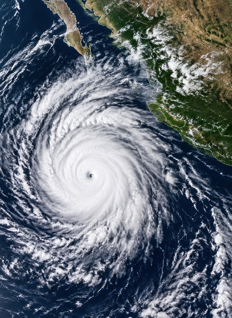
Simon A Cat 4 Hurricane
Pounds Mexico’s Pacific Coast as Dangerous Conditions Threaten Coastal Communities
The powerful hurricane is bringing destructive winds, dangerous coastal flooding and the risk of life-threatening mudslides near western Mexico.
A powerful hurricane is putting Mexico’s Pacific coast on alert as Hurricane Simon moves close to the country’s west-central shoreline. The storm remained a dangerous Category 4 hurricane Sunday, with maximum sustained winds reported at 130 mph in the National Hurricane Center’s 3 p.m. Central Time advisory.
Simon’s core was skirting the coastline near the states of Colima and Jalisco, placing coastal communities and popular tourist destinations at risk from destructive winds, heavy rain and dangerous ocean conditions.
The National Hurricane Center warned that hurricane conditions were occurring or likely along portions of the coast covered by hurricane warnings. Residents were urged to shelter in safe locations and follow instructions from local emergency officials.
Puerto Vallarta and Nearby Coastal Areas Face a Dangerous Night
The storm’s proximity to land is especially concerning for communities near Puerto Vallarta and Cabo Corrientes.
Even when a hurricane’s eye remains offshore, powerful winds and bands of heavy rain can affect communities along the coast. Dangerous waves and storm surge can also push seawater inland, flooding low-lying areas and damaging buildings near the shoreline.
Mexico’s president, Claudia Sheinbaum, urged coastal residents to remain indoors as the hurricane approached. Authorities have taken precautionary measures, including beach closures and emergency preparations, as the storm’s most dangerous conditions threaten the region.
Travelers should check directly with airlines, airports and local authorities for disruptions before attempting to travel.
Torrential Rain Could Trigger Flash Floods and Mudslides
One of Simon’s greatest threats may come from rainfall rather than wind alone.
The National Hurricane Center forecast additional rainfall of 8 to 16 inches across portions of southwestern Mexico, with isolated storm totals potentially reaching 30 inches in parts of Michoacán, Colima and Jalisco through Monday.
Those amounts could produce life-threatening flash flooding, especially where mountainous terrain forces moist air upward and concentrates rainfall over steep slopes.
Rapid runoff can overwhelm drainage systems, flood roads and carry mud, rocks and debris into communities below. Landslides are a particular concern in areas where heavy rain saturates hillsides.
Residents should avoid riverbanks, mountain roads and low-water crossings during periods of heavy rain.
Dangerous Surf and Storm Surge Add to the Threat
Simon is also generating large and potentially destructive waves along Mexico’s Pacific coast.
Storm surge can push ocean water onto normally dry land, while powerful surf can damage coastal structures and flood beachfront properties. Strong rip currents may persist even after the hurricane moves away.
Beaches and waterfront areas should be avoided wherever authorities have issued restrictions or hazardous-surf warnings.
What Happens Next?
As of Sunday evening, the National Hurricane Center continued to track Simon near Mexico’s west-central coast. Forecasters expected the storm to weaken, although it was still forecast to remain a hurricane as it moved near the coast and potentially farther offshore.
The precise impacts will depend on the storm’s track, how closely its core interacts with land and how much additional rain falls over vulnerable areas.
Residents should follow official warnings from Mexico’s civil protection authorities and the National Hurricane Center rather than relying on a single projected track.
The bottom line: Hurricane Simon remains a serious threat to western Mexico. Destructive winds, storm surge, torrential rainfall and possible mudslides could affect communities even if the storm’s center does not make a direct landfall.
SEO keywords
Hurricane Simon, Hurricane Simon Mexico, Category 4 hurricane, Mexico Pacific coast hurricane, Puerto Vallarta hurricane, Jalisco weather, Colima flooding, Mexico storm surge, hurricane landfall forecast, October 2026 hurricane news, tropical cyclone updates
Isaias Remnants: Flood Danger Remains Across the Appalachians and Mid-Atlantic
Heavy rain, rising rivers and possible flash flooding remain concerns as the storm’s remnants move northeast.
The winds have weakened, but the danger is not over. The remnants of Hurricane Isaias continued moving across the eastern United States Sunday, bringing heavy rainfall and renewed flooding concerns to portions of the Appalachians, the Carolinas and the Mid-Atlantic.
According to the National Weather Service, the flash-flood threat was decreasing Sunday, but isolated flooding remained possible in areas that received heavy rainfall. Flood watches and warnings were in effect in parts of the southern and central Appalachians. Source: National Weather Service
Rivers Rise as Heavy Rain Soaks the Mountains
Western North Carolina was among the areas dealing with significant rainfall. Some weather stations in the region reported approximately 5 inches of rain over 24 hours, while one station near Enola recorded 9.57 inches, according to reporting from the Associated Press.
The combination of saturated ground, steep mountain terrain and rising streams can turn heavy rainfall into a dangerous situation quickly. Roads may flood, water can rise rapidly in low-lying neighborhoods, and runoff can trigger landslides on unstable slopes.
Even as rainfall begins to diminish, rivers and creeks can continue rising as water drains from higher elevations into surrounding communities.
Storm Damage Reported Along the Gulf Coast
Isaias made landfall near Destin, Florida, on Friday as a Category 2 hurricane. Its powerful winds damaged buildings, tore roofing from structures and brought down trees across parts of the Florida Panhandle and southern Alabama.
The Associated Press reported at least four deaths linked to the storm and widespread power outages affecting hundreds of thousands of customers.
Emergency crews and relief organizations have been working to help residents recover, while some communities continue dealing with damaged buildings, debris and disrupted services.
Could Tornadoes and Dangerous Surf Still Be a Concern?
The storm’s circulation and associated weather systems can continue producing hazards even after a tropical cyclone loses its hurricane status.
Forecasters warned Sunday that a few tornadoes were possible across portions of Virginia and North Carolina. Dangerous surf and rip currents were also concerns along parts of the Gulf Coast and southeastern Atlantic coastline.
Residents should not assume conditions are safe simply because the storm has weakened. Flooded roads can conceal dangerous currents, and even shallow moving water can sweep away a vehicle.
What Happens Next?
Isaias was classified as a post-tropical cyclone Sunday, with maximum sustained winds of about 25 mph. The National Weather Service forecast the remaining system to continue moving northeast before dissipating.
The immediate concern is shifting from hurricane-force winds to the effects of heavy rainfall, flooding and lingering storm damage.
People in affected areas should monitor local weather alerts, avoid flooded roadways and follow evacuation instructions if authorities issue them.
The bottom line: Isaias may be losing its strength, but its final impacts could still be dangerous. For communities across the Appalachians and Mid-Atlantic, the next concern is how quickly rivers fall and how much additional rain reaches already vulnerable areas.
SEO keywords
Isaias remnants, Hurricane Isaias aftermath, Appalachian flooding, North Carolina flooding, Mid-Atlantic weather, flash flood warnings, Florida hurricane damage, October 2026 weather news, tropical storm aftermath, National Weather Service alerts
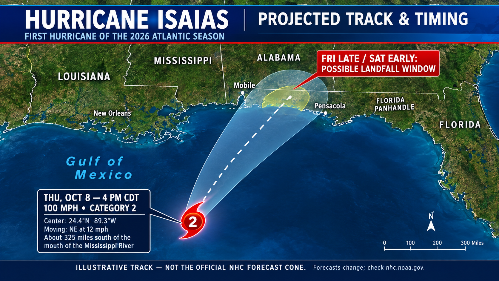
Isaias Breaks Atlantic with First Hurricane!Arrives After an Unusually Quiet Year!
Hurricane Isaias Roars to Life as a Cat 3 Hurricane ! The Atlantic Season’s First Hurricane
After months of waiting, the Atlantic hurricane season finally has its first hurricane of 2026 — and it is heading toward the U.S. Gulf Coast.
Hurricane Isaias strengthened over the warm waters of the Gulf of Mexico, becoming the season’s first hurricane on Thursday, October 8. The late-season development comes after an unusually quiet year, making this a storm that coastal communities cannot afford to ignore.
According to the National Hurricane Center, Isaias had maximum sustained winds of approximately 80 mph in its early Thursday morning advisory. Forecasters warned that additional strengthening was possible as the storm approached the northern Gulf Coast. Source: National Hurricane Center
A quiet season — until now
The Atlantic hurricane season officially runs from June 1 through November 30. Although tropical storms had already formed earlier this year, Isaias is the first system of the 2026 season to reach hurricane strength.
Its arrival in October is particularly notable. The first Atlantic hurricane of the year has developed more than four months into the season, highlighting just how unusual this year’s slow start has been. A strong El Niño has been one factor working against Atlantic storm development by increasing wind shear, which can disrupt developing tropical systems.
The Gulf Coast faces a serious threat
The danger extends beyond powerful winds. Isaias could produce dangerous coastal flooding from storm surge, heavy rainfall, flash flooding and extended power outages. Early forecasts called for 3 to 7 inches of rain across parts of the central Gulf Coast, with isolated totals potentially reaching 10 inches.
Residents along the northern Gulf Coast should monitor official forecasts, review evacuation instructions and prepare for possible power outages. Even communities outside the hurricane’s direct path could experience flooding or hazardous weather.
The bottom line
Isaias is a reminder that a quiet hurricane season is not necessarily a safe one. With weeks remaining before the Atlantic season officially ends, coastal residents should remain prepared and follow updates from the National Hurricane Center and their local emergency management officials.
Stay with us for continuing weather coverage as Hurricane Isaias moves toward the Gulf Coast.
SEO keywords
Hurricane Isaias 2026, first Atlantic hurricane of 2026, Hurricane Isaias forecast, Gulf Coast hurricane threat, October hurricane, hurricane landfall forecast, NOAA Hurricane Center, Florida Panhandle hurricane, Alabama hurricane threat, Mississippi storm surge, El Niño hurricane season, Gulf of Mexico weather, tropical storm updates, severe weather news, Jazz Bishop weather news
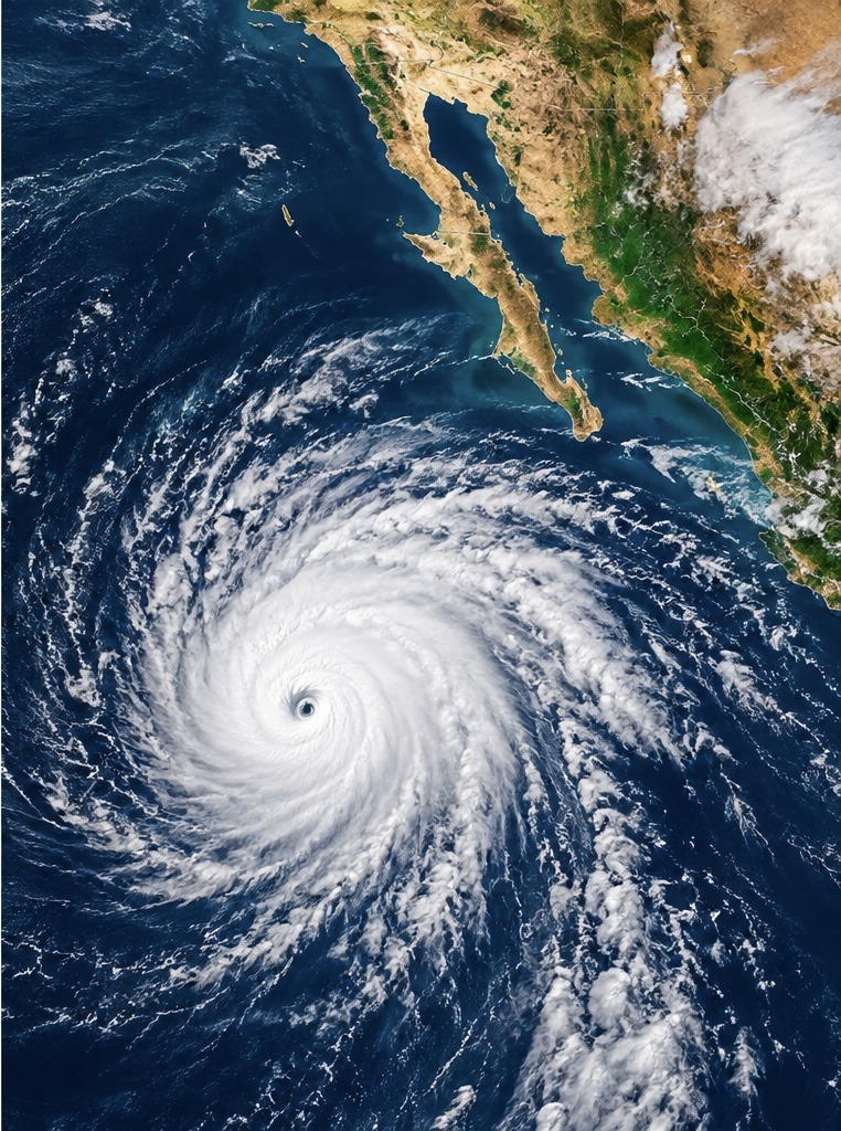
Hurricane Rachel Moves West Away From Mexico
Hurricane Rachel remains a powerful hurricane in the eastern Pacific, but the storm is beginning to move away from Mexico.
As of Sunday afternoon, Rachel had maximum sustained winds of approximately 105 mph, making it a strong Category 2 hurricane. The storm was located about 340 miles (550 kilometers) southwest of the southern tip of Baja California and was moving west at about 6 mph.
The National Hurricane Center says Rachel is expected to slowly weaken beginning Monday, although fluctuations in strength are possible before weakening becomes established. (NOAA National Hurricane Center)
Rachel’s biggest impacts are occurring along the coast rather than from a direct landfall. Large swells generated by the hurricane are producing dangerous surf, strong rip currents and hazardous ocean conditions along portions of Mexico’s Pacific coastline and the Baja California Peninsula.
The storm is expected to continue moving generally westward over the open Pacific, keeping the center away from a direct strike on Mexico.
However, coastal communities and beachgoers should continue to watch conditions because hurricane-generated swells can remain dangerous even when a storm is hundreds of miles offshore.
Rachel is another sign of an unusually active eastern Pacific hurricane season. The storm briefly reached Category 3 strength earlier in its life cycle before weakening somewhat.
Meanwhile, meteorologists are also watching another disturbance south of Mexico that has a high chance of developing later this week, meaning the eastern Pacific could remain busy even after Rachel moves farther offshore. (National Hurricane Center)
Sources: National Hurricane Center and NOAA. (NOAA National Hurricane Center)
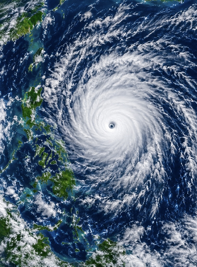
Super Typhoon Choi-Wan Strengthens in the Western Pacific
Super Typhoon Choi-Wan is strengthening as it moves northward across the western Pacific, far east of the Philippines.
As of Monday, October 5, Choi-Wan had maximum sustained winds of about 195 km/h (120 mph), with gusts reaching 240 km/h (149 mph), according to the Philippine Atmospheric, Geophysical and Astronomical Services Administration.
The powerful storm was located roughly 2,600 kilometers (1,620 miles) east-northeast of extreme northern Luzon and was moving north at about 20 km/h.
Although the center of Choi-Wan is remaining well offshore, the storm is already affecting weather across parts of the Philippines. Its broad circulation and trough are producing heavy rain and thunderstorms across portions of Visayas and Mindanao, where flash flooding and landslides are possible.
Choi-Wan is expected to continue moving north and eventually curve toward the northeast. Forecast guidance indicates the typhoon should gradually weaken as it moves into higher latitudes.
The storm is also being closely watched because powerful recurving Pacific typhoons can influence weather patterns thousands of miles away. Choi-Wan’s interaction with the jet stream could contribute to significant weather changes farther north and east later this week.
For now, the greatest concern near the Philippines is heavy rain, flooding, landslides and dangerous marine conditions, while the core of the super typhoon remains over open water.
Sources: PAGASA and NOAA/NESDIS. (PAGASA)
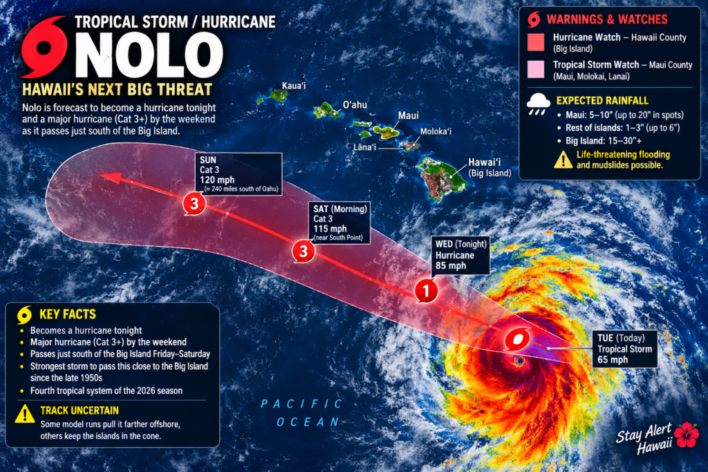
HAWAII TAKES A BEATING AS THE MOST UNUSUAL WEATHER PATTERN EVER EMERGES FROM THE SUPER El NINO
NOLO TAKES AIM AT HAWAII — STORM COULD BECOME A MAJOR HURRICANE
Tropical Storm Nolo is rapidly strengthening south of Hawaii, and forecasters are warning that the storm could become a major hurricane as it approaches the Big Island this weekend.
As of Thursday afternoon, Nolo had maximum sustained winds of about 70 mph and was located roughly 285 miles south of South Point on the Big Island.
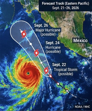
Rapid Development Expected Off Mexico
Tropical Depression South of Mexico Could Rapidly Intensify Into a Major Hurricane
A tropical system south of Mexico is rapidly organizing, and forecasters are warning that it could become a major hurricane within days.
The system, designated Tropical Depression Seventeen-E, was located about 285 miles south of Manzanillo, Mexico, Sunday afternoon.
The National Hurricane Center reported maximum sustained winds of about 35 mph, but conditions around the depression are highly favorable for strengthening.
Rapid Intensification Possible
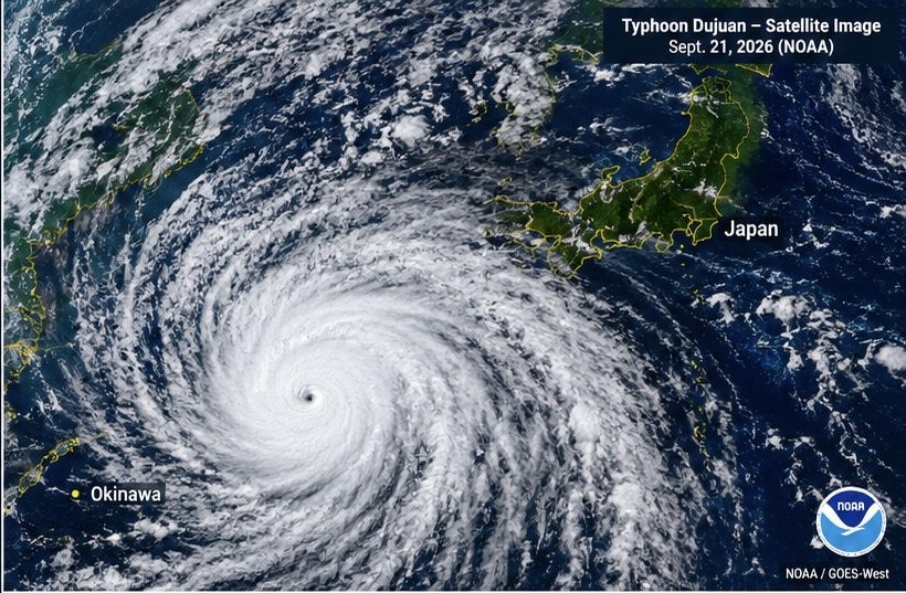
Typhoon Dujuan Threatens Japan
Typhoon Dujuan Threatens Japan With Torrential Rain and Violent Winds
Japan is bracing for Typhoon Dujuan as the powerful storm approaches the country’s eastern coast, threatening heavy rain, violent winds, flooding and dangerous waves.
Dujuan is expected to make its closest approach to eastern Japan on Monday, September 21, putting the Kanto region—including the Tokyo area—on alert during Japan’s Silver Week holiday.
The Japan Meteorological Agency says the storm is expected to pass close to the Kanto-Koshin region Monday afternoon and evening before accelerating northeastward.
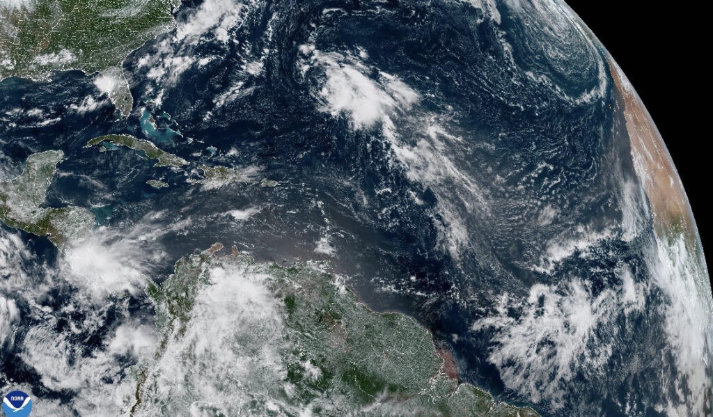
A Historic Standstill in the Atlantic
For a basin that normally becomes increasingly active through August, September and early October, the 2026 Atlantic hurricane season has reached an extraordinary milestone: not a single hurricane has formed.
And now, something interesting is being watched in the central Atlantic.
The National Hurricane Center reported Thursday morning that there were no tropical cyclones currently in the Atlantic basin. However, forecasters are monitoring a disturbance several hundred miles east of Bermuda that has a 40% chance of developing into a tropical cyclone over the next several days.
A record-breaking lack of hurricanes
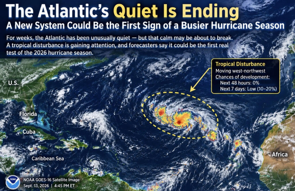
The Atlantic’s Long Quiet Stretch May Finally Be Coming to an End
For weeks, the Atlantic hurricane season has been remarkably quiet.
Now, forecasters are watching a new disturbance in the central Atlantic that could signal the beginning of a change in the basin.

Long Beach Flooding: Hurricane-Driven Waves Tear Into California Coast
Long Beach, California, has been hit by serious coastal flooding and erosion as powerful waves battered the Alamitos Peninsula, damaging the shoreline and threatening beachfront homes.
The flooding was not simply caused by heavy rain. The main culprit was Hurricane Marie, which stayed offshore but generated a powerful swell that traveled toward Southern California. The National Hurricane Center warned that Marie would continue producing dangerous surf along the Southern California coast.

Indonesia Volcano Eruption Disrupts Flights Across the Region
A powerful eruption of Anak Krakatau in Indonesia has caused major disruptions to air travel, with volcanic ash spreading across parts of Java and Sumatra.
The eruption forced authorities to temporarily close eight airports, including Jakarta’s major Soekarno-Hatta International Airport. Volcanic ash reached altitudes of up to approximately 50,000 feet, creating a serious aviation hazard because ash can damage aircraft engines and other critical systems.

Three Storms, One Unusual Pacific
Three tropical cyclones spinning across the Pacific at the same time. Cick into post for video and full story! Radar imagery of an extraordinary scene this week as Lowell, Karina and Marie occupied the Pacific simultaneously. For weather watchers, seeing three systems developing together is a rare and fascinating sight.

Philippines Flooding: Communities Facing a Relentless Monsoon
The Philippines is facing another serious round of flooding as the Southwest Monsoon, known locally as Habagat, continues to bring heavy rainfall across parts of Luzon and the Visayas.
The latest flooding has affected communities across Central Luzon, Metro Manila, CALABARZON and other areas. Government officials and emergency agencies continue to monitor flooded communities, evacuate residents and deliver assistance to people cut off by rising water.