Today, Monday, April 28, 2025, both Iowa and Oklahoma are facing significant severe weather threats. Residents should prepare for the possibility of strong tornadoes, large hail, damaging winds, and flash flooding.
🌪️ Iowa: High Risk for Severe Storms
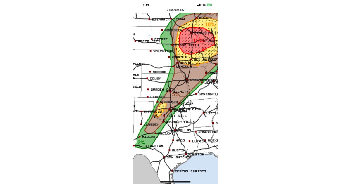
The National Weather Service has issued a Level 4 out of 5 risk for severe weather in northern Iowa, including areas like Mason City and Waterloo. This means there is a high chance of:
- Strong tornadoes (EF2 or higher)
- Large hail (golf ball-sized or larger)
- Damaging winds (up to 80 mph)
Storms are expected to develop between 2:00 PM and 4:00 PM, with the most dangerous period during the late afternoon and evening hours. Residents are advised to stay alert and have multiple ways to receive weather warnings.
🌩️ Oklahoma: Evening and Overnight Storm Threat
In Oklahoma, especially areas west of Oklahoma City, severe storms are expected to begin forming around 4:00 PM, with the highest risk between 6:00 PM and midnight. The threats include:
- Tornadoes, possibly strong and long-tracked
- Large hail (up to baseball-sized)
- Damaging winds
- Flash flooding, especially in areas that have received recent heavy rainfall
The risk level has been upgraded to Level 3 out of 5 for parts of western and central Oklahoma. Residents should prepare for severe weather and have a plan in place.